
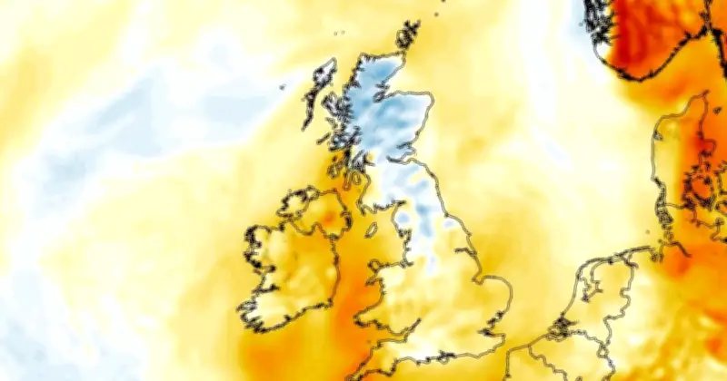
The UK's recent heatwave is set to come to an abrupt end next week, with new weather maps showing temperatures dropping as low as 7C in parts of the country, particularly across Scotland and northern England. Forecasts from WXCharts, generated on July 10 and using ECMWF data, indicate that by 6am on July 19, much of Scotland and northern England will see single-digit temperatures, while cooler air spreads across the UK.
Coldest Conditions in Scottish Highlands
The chilliest conditions are expected across the Scottish Highlands, where overnight lows of 7C to 9C are forecast. Parts of northern England, including the Pennines, are also expected to fall into single figures, with surrounding areas hovering around 10C to 12C. Elsewhere, much of Wales, the Midlands and southern England are forecast to wake up to temperatures between 13C and 16C, while the warmest overnight conditions are expected in the far south-west and along some southern coasts, where temperatures remain around 17C to 20C.
Daytime Temperatures Still Warm
Despite the cooler start, daytime temperatures are still expected to rise as the day progresses. Forecast maps for 6pm show highs of around 25C across parts of central and southern England, including areas of the Midlands and the Home Counties. Much of Wales and south-west England is expected to reach 23C to 24C, while northern England is forecast to see highs between 20C and 23C. Further north, Scotland is expected to remain noticeably cooler, with many areas reaching only 15C to 20C, although parts of eastern Scotland could briefly climb to around 22C.
Cooler Trend Continues into July 20
The cooler trend continues into July 20, with maximum temperatures remaining well below the levels seen during the recent heatwave. Forecast maps suggest much of England will top out at around 22C to 26C, with the warmest conditions confined to the south-west and parts of southern England. Northern England is expected to see highs mostly between 20C and 23C, while Scotland remains in the mid-to-high teens.
Temperature Anomaly Forecast
The latest temperature anomaly forecast also highlights the changing weather pattern. Rather than showing actual temperatures, an anomaly map compares forecast temperatures with the long-term average for the time of year, based on the 1991-2020 climate average. Areas shaded in orange indicate temperatures expected to be above average, while blue colours indicate temperatures are likely to be below. The map for the morning of July 19 shows Scotland and parts of northern England turning blue, indicating temperatures several degrees cooler than is typical for mid-July. Meanwhile, much of England, Wales and Ireland remain slightly above average, although the anomalies are far less pronounced than during the recent hot spell.
Six Scottish Council Areas Affected
According to the forecast, six Scottish council areas could see temperatures around 7C: Highland, Moray, Aberdeenshire, Perth and Kinross, Angus, and Argyll and Bute.
Met Office Long-Range Forecast
The Met Office's long-range forecast for the period July 14 to July 23 reads: "High pressure initially situated to the north of the UK with low pressure over the Bay of Biscay starts the period with broadly settled weather for much of the UK. There will, however, be a risk of thunderstorms spreading into the south of the UK from France at times. Through the weekend potentially turning more unsettled with some rain or showers and thunderstorms at times as low pressure and a more northerly wind affect the UK at times. Temperatures will be warm or very warm for most, perhaps hot at times in the southwest initially, likely easing to warm or near average into the weekend, though further hot spells possible between systems."
Regarding its long-range forecasting, the Met Office warns: "When looking at forecasts beyond five days into the future, the chaotic nature of the atmosphere begins to play a larger part - small events currently over the Atlantic can have potentially significant impacts on our weather in the UK and Ireland in several days' time."




