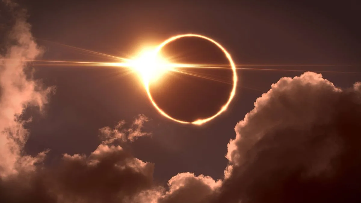
Met Office Confirms February 2024 Was Among UK's Wettest and Dullest on Record
February 2024: UK's Wettest and Dullest Month on Record

The Met Office has officially confirmed that February 2024 ranked as one of the dullest and wettest Februarys ever recorded in Britain. Newly released figures paint a stark picture of a month dominated by persistent, heavy rainfall and a notable lack of sunshine across much of the country.

A Nation Soaked: Regional Rainfall Extremes

Nationally, the UK experienced rainfall totals 23 per cent above the long-term average for February. However, this figure masks significant regional disparities. England bore the brunt of the deluge, receiving a staggering 70 per cent more rain than usual. Worcestershire, in particular, endured its wettest February since records began.

"February's mild and notably dull conditions have brought a winter of considerable contrasts to a close," stated Met Office Science Manager Dr. Amy Doherty. "While February itself stood out for its exceptionally low sunshine and above-average temperatures, the broader winter picture shows just how varied conditions have been around the UK."

Sunshine Deficit and Unusual Patterns

Sunshine was in critically short supply for most regions, thanks to the dominance of cloud-bearing Atlantic weather systems. The UK overall had its fourth dullest February on record, while Wales suffered through its dullest February ever.

In a notable reversal of typical patterns, eastern Scotland recorded above-average rainfall, while parts of northern and western Scotland were markedly drier than usual. "This highlights an unusual reversal of the pattern normally expected, and demonstrates the strong regional differences that can develop within a season," explained Dr. Doherty.

Mild Nights and a Warm Winter Finale

Despite the gloom, temperatures remained unseasonably high. February 2024 was the ninth warmest February on record for the UK, with nights proving particularly mild. Remarkably, 21 counties recorded their highest-ever February minimum temperatures.

The broader winter season (December 2023 to February 2024) also concluded as one of the wettest on record. Several regions, including the West Midlands, Cornwall, and Leicestershire, experienced their wettest winter ever. Counties like Dorset and Warwickshire recorded their second wettest winters, with many areas seeing totals ranking in the top ten since 1836.

The Climate Change Connection

According to the Met Office, climate change is a key driver behind these extreme weather patterns. "A warmer atmosphere can hold more moisture, approximately 7% more for every degree Celsius of warming," the office explained. "This means that when it does rain, downpours can be heavier and more intense. This characteristic is already being observed in the UK and globally."

A Glimmer of Hope for Spring

As the UK steps into meteorological spring, forecasts offer a welcome respite. "This week is the start of meteorological spring, and the forecast is set to reflect the seasonal shift," said Tony Wisson, Deputy Chief Forecaster at the Met Office. "Over the next few days, the conditions are likely to become noticeably more settled."

While a band of rain is expected on Thursday, with showers possible in Northern Ireland and western Scotland, temperatures are predicted to rise. Highs could reach up to 19°C on Thursday, signalling a shift towards warmer, more settled spring weather.

"Taken together, the winter and February figures highlight the influence of a predominantly Atlantic weather pattern and the pronounced variability that can characterise the UK climate," concluded Dr. Doherty, underscoring the complex interplay of factors behind one of Britain's most memorable wet winters.