A new map has revealed the UK towns and cities that would be hit the hardest should a wildfire start and spread. More than 700 wildfires have been recorded across England and Wales so far this year, and with a fourth heatwave under way, the risk of further fires remains high.
Heatwave and health alert
The UK Health Security Agency (UKHSA) has issued an amber heat-health alert for the East Midlands, the East, South East and London. The alert runs from Tuesday to Thursday, with rising temperatures increasing health risks, especially for vulnerable groups.
Temperatures of up to 35C are expected today in south-east England. The Met Office assessment showed that fires could be “exceptionally severe” by Wednesday if they start in parts of London, the South East and eastern England, due to hot, dry conditions.
Wildfire figures and warnings
Fire and rescue services in England and Wales have responded to 706 wildfires so far in 2026, with 208 incidents recorded between July 16 and 28 alone, according to the National Fire Chiefs Council (NFCC). The figures do not include wildfires elsewhere in the UK, such as the major incident in the Cairngorms in Scotland.
The NFCC said the data shows “how quickly wildfire activity can increase during prolonged periods of hot and dry weather”. Fire chiefs warned that wildfire risk “remains elevated across the UK” and that there are “currently eight live wildfire incidents being monitored through national reporting systems”.
Ongoing incidents and prevention
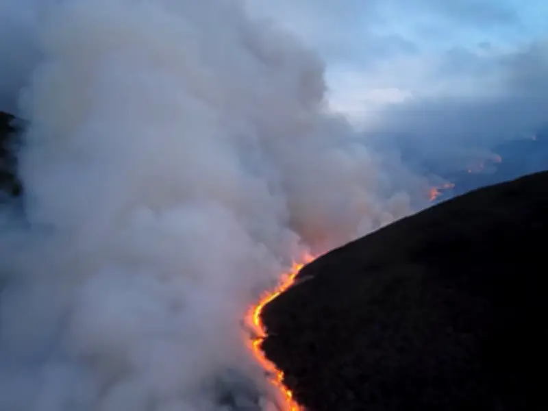
Derbyshire Fire and Rescue Service said firefighters were continuing to “make progress at the major wildfire incident at Tintwistle Moor” after 60 personnel were deployed on Tuesday.
While wildfire numbers in England and Wales are below the 788 recorded by the same point last year, fire chiefs warned that “continued dry conditions, combined with warmer temperatures and harvesting activity in many rural areas” create conditions for rapid fire spread.
Phil Garrigan, chairman of the NFCC, said: “More than 200 wildfires in just 12 days shows how quickly the risk can escalate when hot, dry conditions take hold. The scenes we’re seeing across parts of Europe are a stark reminder of what a changing climate means for fire and rescue services.” He added that while the UK is not seeing fires of that scale, the science suggests larger, more frequent and more complex wildfires in the future, requiring continued investment in specialist capabilities, but added: “Prevention remains our strongest defence. Most wildfires are avoidable, and we’re asking everyone to take extra care during the hot weather to help keep their communities safe.”
Government investment and human causes
A Ministry of Housing, Communities & Local Government spokesperson said: “We’re investing nearly £100 million to help replace assets which can be used to tackle wildfires, including dedicated off-road vehicles which are suitable for England’s landscape. This includes rolling out a pilot to place highly trained firefighters who specialise in wildfire response in key locations across England, working with industry experts to ensure this approach is tailored to the unique wildfire risks here.”
Fire chiefs said many wildfires are caused by everyday human activity, adding that “disposing of cigarettes safely, avoiding the use of disposable barbecues in open spaces and taking litter home can significantly reduce the risk of fires starting”.
Provisional Met Office data shows July has been 3C above average across the UK, potentially putting it among the hottest three or four months of July on record.