The Met Office has explained the exact reason why thunderstorms frequently occur after periods of intense heat, a pattern observed across the UK following recent heatwaves. The phenomenon is driven by atmospheric instability caused when hot, humid air near the ground meets cooler air higher up.
During a heatwave, the sun heats the Earth's surface, warming the air directly above it. This warm air rises rapidly because it is less dense than the cooler air surrounding it. As it ascends, it encounters cooler temperatures at higher altitudes, causing water vapor to condense into cumulonimbus clouds—the towering clouds associated with thunderstorms.
Key Factors Behind Thunderstorm Development
According to Met Office meteorologists, three main ingredients are necessary for thunderstorm formation: moisture, instability, and a lifting mechanism. Heatwaves provide ample moisture from the ground and lower atmosphere, while the intense solar heating creates strong instability. The lifting mechanism can be provided by the heat itself, or by fronts or sea breezes.

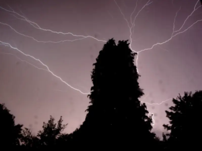
When the warm, moist air rises, it cools and condenses, releasing latent heat that further fuels the updraft. This process can lead to the formation of cumulonimbus clouds that can reach heights of over 10 kilometers. Within these clouds, ice particles collide, generating electrical charges that result in lightning and thunder.
Impact and Frequency in the UK
The UK has seen an increase in thunderstorm activity following recent heatwaves. For example, after the July 2022 heatwave, which saw temperatures exceed 40°C for the first time, widespread thunderstorms caused flash flooding and power outages. The Met Office noted that such storms are becoming more frequent due to climate change, as warmer air can hold more moisture, increasing the potential for heavy rainfall and lightning.
Thunderstorms can bring hazards including lightning strikes, hail, strong winds, and sudden downpours leading to flooding. The Met Office advises staying indoors during storms and avoiding open areas, tall objects, and water bodies.
Forecasting and Preparedness
The Met Office uses advanced weather models and satellite data to predict thunderstorm development. They issue yellow, amber, or red warnings depending on the severity and likelihood of impacts. For the latest forecasts, the public is encouraged to check the Met Office website or app.
Understanding the science behind heatwave-to-thunderstorm transitions helps in better preparation and response, reducing risks to life and property.