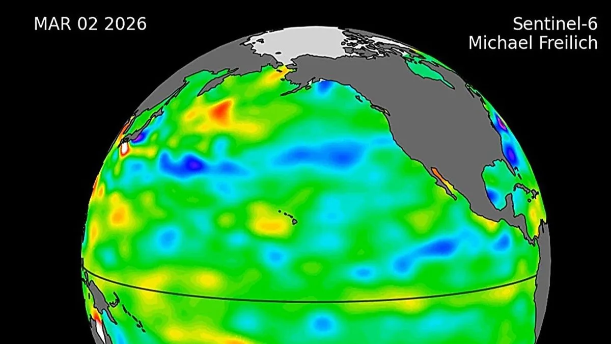
New satellite images from NASA and the European Space Agency have revealed a significant swell of warm water moving eastward across the Pacific Ocean, leading scientists to warn of a potential Super El Niño event later this year. The data, collected by the Sentinel-6 Michael Freilich satellite, shows sea surface temperatures rising between 1.5 and 2 degrees Celsius above average, which could surpass the record-breaking El Niño of 1997-1998.
The phenomenon, known as a Kelvin wave, consists of a pool of water approximately 13.5 degrees Fahrenheit warmer than normal. This wave has been tracked since January, when a small wave formed near Micronesia. After dissipating in February, another wave emerged in March and has since moved eastward. By mid-May, sea levels off the coast of Peru were over 5.9 inches higher than average, indicating the arrival of warm water.
Josh Willis, a sea-level researcher at NASA's Jet Propulsion Laboratory, noted that while this year's event started later than the major El Niños of 2015 and 1997, it is beginning to catch up. The National Oceanic and Atmospheric Administration's Michelle L’Heureux added that the current Kelvin wave is impressive and rivals the one seen in 1997.

El Niño events are driven by weakened or reversed trade winds, which normally blow from east to west along the equator. When these winds falter, warm water accumulates in the eastern Pacific, altering rainfall and wind patterns globally. This can lead to heavy precipitation in some regions and severe droughts in others, impacting both ecosystems and economies.
Experts from Severe Weather explained that Kelvin waves are triggered by wind bursts pushing warm water eastward. The current wave's size and temperature suggest that the upcoming El Niño could be one of the strongest on record, with potential consequences for weather patterns worldwide.