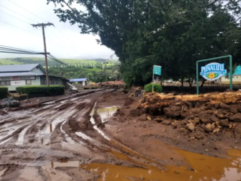
Tropical Storm Moke is poised to slam into the south of Hawaii’s islands, with forecasters predicting heavy rains and strong winds on Saturday evening, just days after the region was hit by Hurricane Lala.
Big Island Expected to Bear the Brunt
As with Hurricane Lala, the Big Island is expected to bear the brunt of Moke’s rain and heavy winds as it passes south of a direct hit late on Saturday and into Sunday.
Moke will then continue its westward path near the islands through to early Tuesday, said Casey Oswant, a meteorologist with the National Weather Service in Honolulu.

“There will still be impacts, especially to the windward and south-east sides of the Big Island, but it will probably be a little bit more limited than what we saw with Lala,” Oswant said.
Rainfall Predictions and Warnings
Rainfall predictions for this weekend for the south-east and windward sides of the Big Island were 5-10in (13-25cm), with as much as 15in (38cm) in isolated areas, according to Casey Oswant, an NWS meteorologist.
Across the rest of the island chain, 1-2in (2-5cm) of rain was expected, though parts of east Maui could see up to 4in (10cm), she said.
The NWS has warned that flooding and mudslides could be observed, particularly in areas that received strong precipitation during Hurricane Lala.
Officials Urge Preparedness
Hawaii governor Josh Green and other state officials held a news conference ahead of Moke, urging people to prepare by restocking food, medicine and other essentials.
In a Saturday video, Green said there had already been at least $43m of damaged infrastructure on the Big Island, and another $4.6m damage to homes from Lala.
“There’s going to be a lot more to account for and we will be there to provide recovery and resources, but it’s going to take some time.”
There were no coastal watches or warnings in effect early Saturday morning, but people were urged to closely monitor the storm’s progress. The rainfall has the potential to cause dangerous rip currents, life-threatening flooding and mudslides, especially in steep areas and places where the ground remains saturated, according to the National Hurricane Center.