The Met Office has forecast temperatures could climb as high as 28C in parts of the UK on Friday. Conditions are set to warm up — but forecasters suggest wet and windy weather could be on the way next week.
Friday's warm spell
Thursday has been largely dry for most parts of Wales and the UK, with temperatures reaching the low-20s in most places. On Friday, temperatures are anticipated to peak at between 27C and 28C across the south-east of England. The Met Office has characterised these conditions as "exceptionally warm" for this time of year.
According to the Met Office, Wales will see something of a mixed bag of weather on Friday, with Cardiff enjoying some dry and sunny temperatures of around 21C. As a whole, however, Wales will see a "cloudy and at times damp day with showery rain".
Weekend outlook
Across the weekend, the outlook for Wales is: "Bright and breezy on Saturday with sunny spells and the odd shower. Turning windier on Sunday with heavy rain arriving, clearing later. Sunny periods on Monday. Temperatures remaining above average."
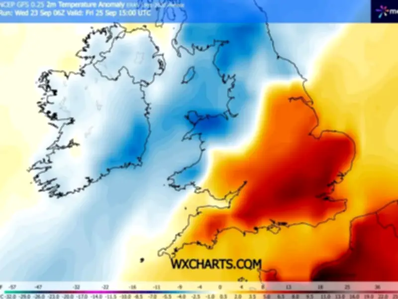
As for England, temperature anomaly maps for Friday show southern and eastern parts of England shaded in orange, further indicating that the mercury will climb well above the seasonal norm.
Met Office deputy chief forecaster Dan Holley said: "Once early fog patches clear in the south, Friday will be exceptionally warm for late September, especially in the southeast closest to an area of high pressure over the nearby continent."
Wet and windy next week
A weakening cold front will drift gradually south-eastwards overnight and into Saturday, with temperatures falling back closer to average over the weekend. "This sets up a mixed weekend of weather, much of Saturday will be fine and dry before an increasing chance of rain or showers on Sunday, especially in more western parts."
The Met Office forecast for next week states that "a period of wet and windy weather" is expected to arrive on Tuesday and Wednesday. Mr Holley added: "While details are naturally uncertain at this range, a particularly deep area of low pressure could pass close to the UK during the first half of next week. This may bring some wet and windy weather for some, which coupled with high spring tides could bring impacts to some coastal areas in the west."