The Met Office says weather in the UK next week could be impacted by a hurricane causing chaos on the other side of the world. Hurricane Isaias has left hundreds of thousands of people without power this week in Alabama, Georgia and Florida, and caused four deaths. While no such devastation is on the cards in the UK, the storm could still have a major influence over our weather, with another system forming in the Atlantic from Tuesday.
Atlantic System to Intensify
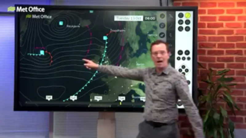
Met Office meteorologist Alex Deakin explains: “Out in the Atlantic there’s another area of low pressure. This one’s really got our attention, we do need to keep a very close eye on this. Starting to really form on Tuesday.”
“Crucially, it is crossing the jet stream. When these weather systems do that, they often intensify. It looks as if it’s going to go between the UK and Iceland, with the strongest winds on the southern flank. It could get very windy, but it depends on the exact track of it.”
Hurricane Fuels the System
Deakin explained this weather system is being “fuelled” by a temperature contrast either side of the jet stream close to North America, with cold air to the north and warm air to the south. Some of the warm conditions on the south side are coming from where Hurricane Isaias is making landfall in the US, hence powering the weather system towards the UK.
“At the moment, the likely track is for it to drift up between the UK and Iceland. But obviously, there’s a lot to happen between now and next Tuesday night.”
BBC Weather Forecast for Next Week
The BBC forecast for next week states: “Windy on Tuesday with a band of cloud and rain moving in, followed by sunshine. Scattered heavy showers will push into northwestern Scotland by the evening.”
“Wednesday will be very windy in the north with cloud and a few spells of rain later on. Dry and sunny further south. Rain in the north to start on Thursday, pushing into central areas later. Staying dry in the south-east.”