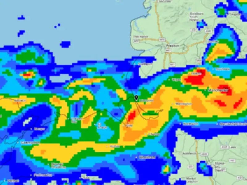
A yellow weather warning remains in place for Merseyside until 10pm on Thursday, with thunderstorms and heavy rain expected to bring disruption across the North West.
The Met Office issued the initial warning for several regions, which came into force on Wednesday (August 26) at 3am and lasts until 10pm. A second yellow warning will come into force on Thursday at 6am until 10pm, covering a larger part of the UK compared to Wednesday.
Regions and forecast details
Regions included in the alert are the North West, South West, London and South East, East of England, East Midlands, Wales, West Midlands and Yorkshire and Humber.

The Met Office said: "Thunderstorms and heavy rain may lead to some disruption."
More information from the Met Office for Thursday's weather forecast said: "A broad band of thunderstorms and heavy rain will move north across England and Wales, perhaps becoming slow moving in the afternoon and evening."
Rainfall and hazards
Accumulations of 20-30 mm in three hours can be expected fairly widely and up to 50 mm in a 12 hour period can be expected in places. There is a small chance that some places may see more than 50 mm in three hours and more than 75 mm through 12 hours, especially over east facing high ground.
"Lightning and hail of 1-2 cm will also be hazards and, in a very few places, strong gusts may also present a hazard, these most likely in the south of England early on Thursday morning."
Timing in Liverpool
Weather maps show deep blue patches of rain sweeping across Merseyside on Wednesday evening. From 5.30pm, rain is expected to make its way across the North West, before clearing up later in the night.
It remains largely dry overnight, before patches of rain are visible around midday on Thursday. The weather map shows patches of blue, signalling heavy showers at 1pm. It looks to be a wet afternoon overall, before the rain moves further up north in the evening.
Advice and potential impacts
Met Office chief forecaster Steve Willington said: "On Thursday, slow-moving heavy and thundery rain may bring prolonged rainfall to some areas, increasing the risk of localised impacts."
"There remains some uncertainty around where the heaviest rain will fall, so it is important to keep up to date with the latest forecast and warnings."
Driving conditions could be impacted by the wet weather, and spray and sudden flooding could lead to road closures.
Advice from the Met Office said: "Consider if your location is at risk of flash flooding. If so, consider preparing a flood plan and an emergency flood kit."
"Prepare to protect your property and people from injury. Before gusty winds arrive, check to ensure moveable objects or temporary structures are well secured. Items include: bins, garden furniture, trampolines, tents, gazebos, sheds, and fences."
"Give yourself the best chance of avoiding delays by checking road conditions if driving, or bus and train timetables, amending your travel plans if necessary."