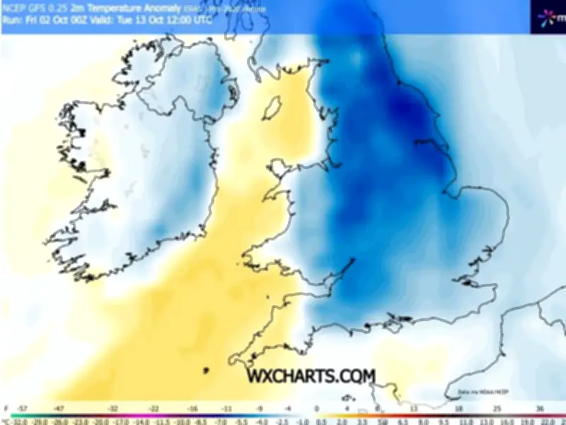
New weather maps from the GFS model indicate that the UK is set for a significant cold snap in mid-October, with temperatures falling well below the seasonal average. Anomaly charts show the nation covered in deep blue patches, signalling that the mercury will dive beneath typical expectations for this time of year.
The data points to a particularly cold day on October 13, when afternoon temperatures could fall under 10C nationwide. Peak readings of only 7C are forecast for London, South Wales and the Midlands.
Only 14 counties expected to reach 10C
By 6pm on October 13, the charts show maximum temperatures reaching 13C in the extreme south-west. Only sections of South Wales and southern England are projected to climb into double figures, meaning millions of Britons face an entire day where the mercury will not rise above 10C.
Just 14 counties are expected to see possible highs of 10C or above on that date, all located in South Wales or southern England. The counties are Essex, Surrey, Kent, Berkshire, Hampshire, Wiltshire, Somerset, Dorset, Devon, Cornwall, Monmouthshire, Glamorgan, Carmarthenshire and Pembrokeshire.
El Nino could bring extreme winter weather
This chilly outlook comes as meteorologists have warned that this year's El Nino, anticipated to be the most powerful on record, could deliver extreme wintry conditions over the next couple of months. The Met Office stated: "Through the latter part of the winter, following a peak in El Nino, the stratospheric Polar Vortex can become weaker, leading to an increased chance of Sudden Stratospheric Warming events unfurling, increasing the potential for cold weather."
Despite its name, Sudden Stratospheric Warming (SSW) can trigger brutally freezing conditions. It was responsible for the Beast from the East in 2018, which delivered 22 inches of snow to certain areas of the country in February and March that year. While SSW does not invariably produce these effects, the Met Office says a cold spell "follows more often than not".
Cold air sweeping across Britain
A separate WXCharts map reveals a large swathe of colder air sweeping across Britain and northern Europe, with the coldest air again focused over North West Scotland and blue shading reaching southwards across much of England and Wales.
Given that these maps are projecting almost two weeks into the future, the precise temperatures and regions affected could still shift as fresh forecasts come in.