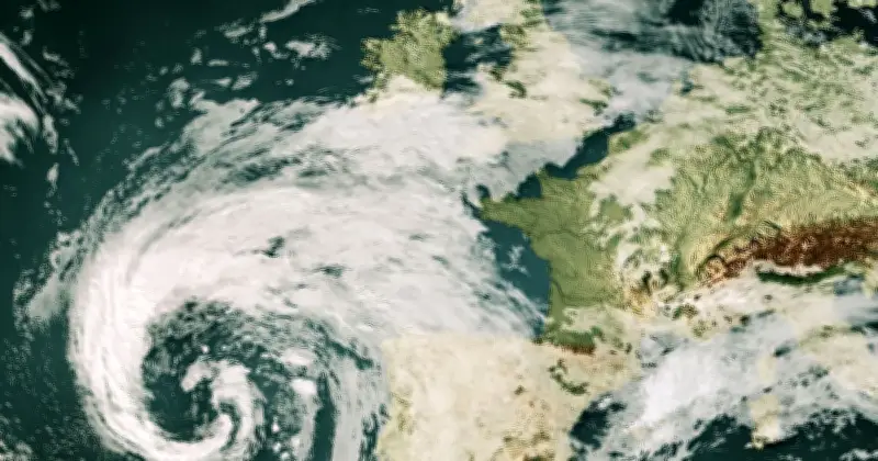
The Met Office has warned that Storm Austen could undergo explosive cyclogenesis, also known as a 'weather bomb', as it strengthens over the Atlantic, with pressure at its centre potentially falling by at least 24 hectopascals within 24 hours. This rapid deepening has prompted amber and yellow wind warnings across 65 areas of the UK for Friday, October 23 and Saturday, October 24.
Jet stream interaction drives rapid deepening
In its latest weather blog issued on Wednesday, the Met Office explained that the storm's interaction with a powerful jet stream over the Atlantic has allowed it to deepen 'rapidly' as it approaches north-west Europe, including the UK.
The Met Office stated: "Storm Austen has been able to deepen rapidly because of its interaction with a powerful jet stream over the Atlantic. As the storm crosses the jet stream and enters the 'left jet exit region,' conditions high in the atmosphere support falling pressure at the surface, helping the low-pressure system strengthen rapidly."
The jet stream, a band of strong winds high in the atmosphere, plays a key role in steering and developing weather systems. Within it, sections known as jet streaks can have stronger winds than the surrounding flow. Storm Austen is expected to interact with a developing jet streak, with a sharpening trough engaging with a baroclinic zone, where contrasting air masses create a strong temperature gradient. This interaction supports the jet streak's development and creates conditions favourable for rapid deepening.
Forecast for the UK
The Met Office added: "Current forecasts indicate that the pressure at the centre of Storm Austen could fall by at least 24 hectopascals within 24 hours. This rapid fall in pressure is known as explosive cyclogenesis and is sometimes described as a 'weather bomb'."
The fastest development is expected during Thursday as the system interacts with the jet stream and moves towards the UK and nearby parts of Europe. By the time Austen moves closer to the UK, its rate of deepening is expected to slow as the storm reaches maturity, but it will remain a deep and potentially impactful area of low pressure.
The strongest winds are expected in the UK on Friday morning, especially in the southwest. An amber wind warning has been issued for southwest England on Friday between 3am and 10am, while a yellow wind warning covers a larger area of southwest and southern England and south Wales between 12am and 2pm. Those in amber areas have been advised to stay indoors where possible, and households in affected areas have been urged to stockpile in case of power cuts.
Potential impacts and advice
Strong winds could damage buildings, bring down trees, and cause disruption to power supplies and other utilities. Exposed roads and bridges may be affected, while rough seas could disrupt maritime travel through the English Channel and create dangerous conditions around some beaches.
Met Office Deputy Chief Forecaster Chris Bulmer said: "Storm Austen is expected to bring a spell of impactful weather to parts of the UK from Thursday night and through Friday. While there remains some uncertainty in the exact track of the storm, there is increasing confidence in the potential for disruptive winds across parts of southwest England, which is why an Amber warning has been issued."
He added: "Winds gusts could potentially reach 60-70 mph for a time, and these strong winds will be combined with spells of heavy rain. People in affected areas should keep up to date with the latest forecast and warnings as the event develops."