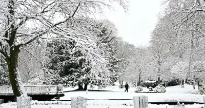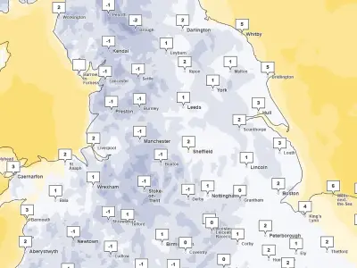
Weather maps from forecasting service WXCharts indicate that several areas of the UK could see snow in the coming days as temperatures drop to wintry lows. The maps show snow reaching depths of around 10 inches in some places, with a long sheet of snow covering much of Scotland while the rest of the UK experiences rain and rather low temperatures.
Snow Expected on Tuesday, November 17
According to WXCharts' current forecast maps, the following areas are set for snow on Tuesday, November 17. In England: Northumberland, Tyne & Wear, County Durham, Cumbria, Lancashire, and North Yorkshire. In Scotland: Aberdeenshire, Angus (Forfarshire), Argyllshire, Ayrshire, Banffshire, Berwickshire, Buteshire, Caithness, Clackmannanshire, Cromartyshire, Dumfriesshire, Dunbartonshire (Dumbartonshire), East Lothian (Haddingtonshire), Fife, Inverness-shire, Kincardineshire, Kinross-shire, Kirkcudbrightshire, Lanarkshire, Midlothian (County of Edinburgh), Moray (Elginshire), Nairnshire, Orkney, Peeblesshire, Perthshire, Renfrewshire, Ross-shire, Roxburghshire, Selkirkshire, Stirlingshire, Sutherland, West Lothian (Linlithgowshire), and Wigtownshire. In Northern Ireland: County Derry.
The snowfall is expected to be heaviest in Scotland, with temperatures falling below zero in both Scotland and northern England on Tuesday. In parts of Scotland, conditions could dip as low as minus 5C. Current maps show snow stretching from the northern tip of mainland Scotland all the way down to Yorkshire.
Met Office Outlook
The Met Office warns of possible thundery showers in parts of the country over the weekend, while next week will see unsettled and changeable conditions for a number of regions. From Tuesday, November 17 to Thursday, November 19, the Met Office warns of possible hill snow for North Wales, northern England and Scotland.
Its outlook for Tuesday to Thursday reads: "Staying unsettled over the next few days with the risk of hill snow for North Wales, northern England and Scotland. Staying cold but temperature returning to average in the south."
For the period between November 20 and November 29, the Met Office's forecast currently says: "A changeable pattern is likely during this period with Atlantic frontal systems spreading across the UK. This means spells of rain and perhaps strong winds will move over the UK at times, with cooler, drier interludes between systems. Rainfall will probably be most frequent in parts of the south and west, and some snow is likely in the north at times. Temperatures are expected to be near normal overall, mildest in the south and coldest in the north."
Later in November, spells of rain and strong winds are possible thanks to Atlantic frontal systems coming in over the UK, the Met Office says. Later in the week, some snow may appear over Scotland, but England, Wales and Northern Ireland look relatively clear.