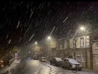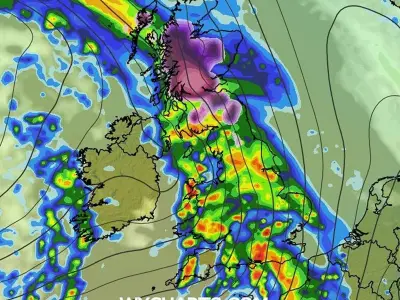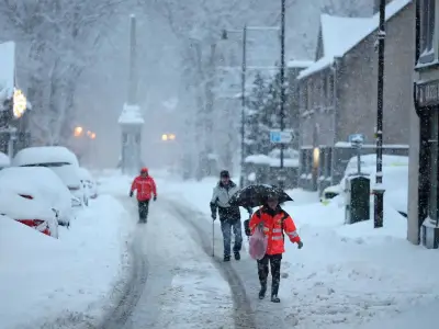
New weather charts show a 42-hour wintry blast set to sweep across the UK before December begins, with significant snowfall expected across northern Britain. Maps from WXCharts, using data from the ECMWF weather model, have turned purple, indicating accumulating snow depths across large parts of the country.
Snow to Start on November 28
The wintry conditions are forecast to begin at 6pm on November 28 and continue until 12pm on November 30. On the Saturday evening, snow is expected to push into western Scotland and the Highlands, with early accumulations building over higher ground around Fort William and the Cairngorms. A band of heavy rain is also set to sweep across England, Wales and Northern Ireland.
Conditions are projected to deteriorate rapidly overnight into Sunday, November 29. By 6am, the maps show heavy snowfall spreading southwards into northern England, with intense bursts falling at rates of up to several millimetres per hour in Cumbria, Northumberland, County Durham and parts of North Yorkshire. A deep area of low pressure in the Atlantic will continue to drive heavy, squally rain across the Midlands, Wales and southern England.
Snow Depths Reach 20cm
By 6am on Monday, November 30, snow depth maps reveal widespread purple shading across the Scottish Highlands, central belt and Southern Uplands, indicating between 10cm and 20cm of lying snow, with isolated peaks in the mountains potentially seeing deeper drifts. Patches of lying snow are also visible stretching down into the Pennines and the Lake District.
The final bursts of fresh snow are forecast to linger across central and northern Scotland and the Pennines until 12pm on Monday, with a deep low-pressure system sitting directly over northern Scotland. While the falling snow eases off after midday, deep accumulations will remain on the ground across high-risk areas.
Met Office Cautious on Forecast
The Met Office remains cautious about the exact track of incoming weather systems, noting that colder air in the north will battle milder Atlantic fronts pushing in from the west. Its long-range forecast for November 23 to December 2 reads: "Bands of rain will move in from the Atlantic at times, making erratic and uncertain eastward progress across the UK. These systems may also bring occasional strong winds. Either side of bands of rain a mixture of clear/sunny spells and showers."
The forecast adds: "Often rather cold in northern areas which could allow precipitation to fall as snow at times, mainly over hills. Generally milder in the south though still potential for some cold nights in clearer spells. Through late November, there is an increasing chance that high pressure will start to have more influence bringing more settled conditions, particularly across the north, with southern areas remaining more prone to milder and wetter weather."
Regarding long-range forecasting, the Met Office warns: "When looking at forecasts beyond five days into the future, the chaotic nature of the atmosphere begins to play a larger part - small events currently over the Atlantic can have potentially significant impacts on our weather in the UK and Ireland in several days' time. Therefore, whilst we can still forecast the general feel of the weather to a relatively high level of accuracy using our ensemble models, it becomes harder to offer local detail to as high a level of accuracy as our shorter range forecasts."