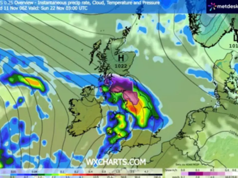
Weather maps indicate temperatures are set to plunge as low as -7C in parts of the UK before snow spreads across the country. The West Midlands and north-west England have been warned of lows around -6C this week, with yellow cold health alerts already issued by the UK Health Security Agency (UKHSA).
Cold snap deepens through November
New GFS weather models show temperatures falling to 5C in the south-east of England by midday on November 21, with 3C in South Wales, 2C in the Midlands and -4C in northern parts of England. Northern Scotland could see -7C, according to The Mirror.
The maps also indicate snow could arrive from midnight on November 21, affecting the north-west of England and southern parts of Scotland. In Wales and England, rain is expected to fall.
Snowfall intensity and accumulation
By 3am on November 22, the maps show more snow heading for northern England as well as southern and central Scotland. At its peak, the GFS model suggests snow could fall at a rate of up to 1cm per hour.
Over the Pennines, snow maps show 10cm (four inches) could settle, with 6cm (2.3 inches) in the Yorkshire Dales and 4cm (1.6 inches) in southern Scotland. As many as 24 counties could see snow, all in northern England or Scotland.
Counties affected
In England, the counties facing snow include Derbyshire, Cheshire, Lancashire, Yorkshire, Cumbria, Durham and Northumberland. In Scotland, the list includes Buteshire, Renfrewshire, Lanarkshire, Wigtownshire, Dumfriesshire, Selkirkshire, Peeblesshire, Ayrshire, Kirkcudbrightshire, Roxburghshire, West Lothian, Midlothian, East Lothian, Berwickshire, Dunbarton, Stirlingshire and Argyllshire.