
UK Snow Maps Reveal Five Regions Set for Weekend Blanketing as Temperatures Plunge
Britain's weather is poised for a dramatic reversal as wintry conditions make an abrupt return following the recent mini heatwave. According to detailed weather maps, five specific regions across the UK are expected to be blanketed with snow over the coming weekend, with temperatures forecast to nosedive to as low as -1 degrees Celsius.
Arctic Snap Brings Sudden Chill After Warm Spell
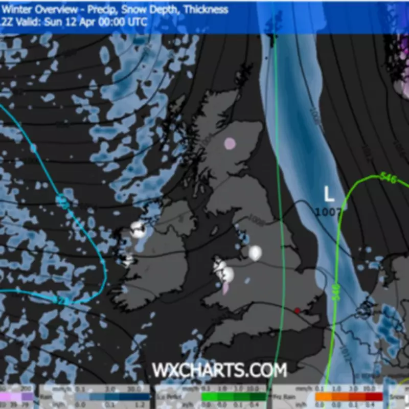
The nation is bracing for a complete shock to the system as a bitter Arctic snap sweeps in, rapidly replacing the recent 20C plus warm conditions. Weather maps from WXCharts, utilizing MetDesk data, clearly illustrate this sharp transition, showing significant temperature drops and precipitation patterns that indicate snowy conditions for several areas.
From Friday, April 10th, temperatures are expected to plummet dramatically, with the Scottish Highlands predicted to feel the harshest chill at -1C. Meanwhile, other northern regions like the North West will experience a noticeable freshness with temperatures hovering between 2C and 3C.

Specific Regions Identified for Snowfall
The weather maps pinpoint three initial regions set to see snowfall on Friday:
- Cheshire
- Gwynedd
- Scottish Highlands
As the weekend progresses, the snowfall is forecast to expand to include two additional regions by Sunday:
- Argyll and Bute
- West Midlands
This brings the total to five regions facing potential snow coverage over the weekend period. The maps suggest that while some areas will experience snow, others will contend with cold rain and drizzle, particularly on Sunday when weather maps show extensive blue coverage indicating precipitation.
Temperature Contrasts Across the Nation
The temperature drop will be felt nationwide, though with significant regional variations. London is expected to reach roughly 6C – warmer than northern areas but still considerably colder than recent days. The cool air will persist throughout the weekend, with the entire nation experiencing temperatures below 8C.
By Sunday, the north east can anticipate a particularly chilly high of just 5C. This represents a substantial departure from the recent warmth, with the Met Office noting that temperatures will slide back to "near average" for the season during this Friday to Sunday period.
Met Office Forecast Details
The national weather service provides specific details for the immediate forecast period: "Chilly start Friday then sunny intervals, cloud thickening later. Rain and strong winds Saturday morning, isolated showers later. Sunshine and showers Sunday. Temperatures near average for April."
Looking further ahead, the Met Office long-range forecast covering April 13 to 22 warns that conditions will remain "changeable," with scattered rain interspersed with drier periods. Their statement clarifies: "It will likely remain rather changeable during the first part of this period, with showers or occasional longer spells of rain interspersed with drier interludes."
This weather shift serves as a reminder of April's unpredictable nature, with the nation transitioning rapidly from unseasonable warmth to wintry conditions that may affect travel, outdoor activities, and daily routines across multiple regions.


