
The Met Office has issued a forecast indicating a strong chance of seeing the Aurora Borealis, or Northern Lights, across parts of the United Kingdom tonight. The natural phenomenon occurs when charged particles interact with gases in Earth's atmosphere near the magnetic poles, typically visible over Northern Scotland, Iceland, and Greenland.
According to the Met Office, the lights are expected to be visible over Northern Scotland and possibly most of Scotland where skies remain clear this evening and overnight. The forecast suggests that the best chance for sightings will be in northern regions, but there is also a possibility for those further south using long exposure photography.
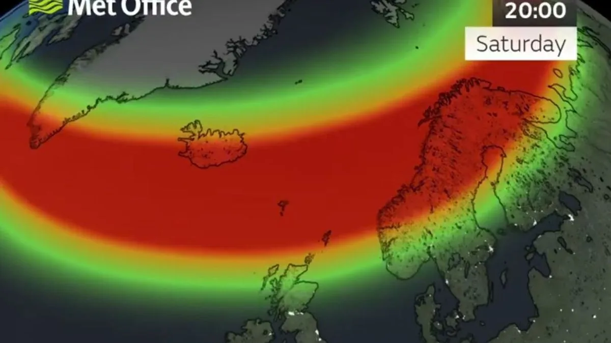
In a statement on X, the Met Office said: “Through this evening and overnight, aurora sightings are possible over northern Scotland and potentially over much of Scotland where skies remain clear. There is perhaps a chance further south too, with long exposure photography.”

A map shared by the Met Office shows the lights will first be visible at Shetland around 6pm, with much of Northern Scotland able to see them just after 7pm. By 8pm, the chance to see the lights will peak, predicted to be visible across all of Scotland wherever the sky is clear.


