The Met Office has forecast that Liverpool will experience very warm sunny spells on Saturday, June 27, before temperatures drop overnight and into Sunday. The region has been enduring a scorching heatwave this week, with weather warnings in place since Monday.
Saturday's Peak and Evening Drop
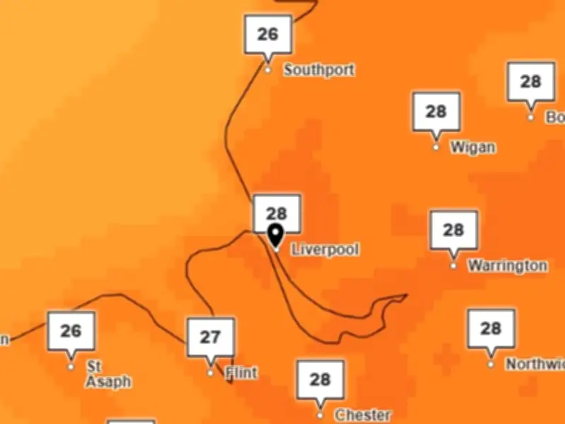
The Met Office stated: "[Today] will be largely dry today with very warm spells. A little cloud will bubble up in the afternoon across the south of the region perhaps with a few showers later in the afternoon. Feeling very warm in the sunshine. Maximum temperature 28C."
Saturday evening is expected to be "a dry and warm evening with late sunshine," but skies will cloud over through the night with some outbreaks of rain in the early hours. Temperatures could drop as low as 12C overnight.

Sunday's Cooler Outlook
Sunday will be cloudy at first with a "few showery outbreaks of rain," according to the Met Office. It added: "Turning drier through the day with increasing amounts of sunshine. Maximum temperature 21C."
Record-Breaking Week
Merseyside saw unprecedented temperatures this week, reaching around 33C. Liverpool John Lennon Airport issued travel advice to passengers, while train passengers were urged to avoid non-essential travel. The Mersey Ferries explorer cruises were also cancelled due to technical issues.
More than a thousand schools in England and Wales either fully or partially closed due to the blistering heat, while others changed uniform policy to allow students to wear PE kit.
Friday was confirmed by the Met Office as the UK’s hottest June day on record, with a provisional temperature of 37.3C recorded in Santon Downham, Suffolk, surpassing the high of 36.7C recorded in Merryfield, Somerset, on Thursday. These smashed the long-standing record for June heat, which dates back to the summer of 1976, by more than 1C, a significant margin given such records are usually broken by only a fraction of a degree.
Climate Change Impact
Scientists warned that the heatwave would have been virtually impossible 50 years ago, with human-driven climate change fuelling more intense and frequent extreme heat events. The heatwave was driven by a "heat-dome" – an area of high pressure that stalls over a region and traps heat – settling over western Europe and bringing extreme conditions across the continent.
Met Office chief forecaster Andy Page said: "The UK is seeing a gradual shift in conditions over the weekend, with those to the southeast of England retaining the warmth the longest, where an amber extreme heat warning remains in force through much of Saturday, though peaks are more likely to be in the low 30s Celsius."
Week Ahead
The Met Office said next week will bring a mixed picture for the UK’s weather, with a combination of cloudy and sunny spells, as well as influxes of rain from the west at times. A drop in temperatures will develop in the west first, with these fresher conditions spreading slowly further east over the weekend.