
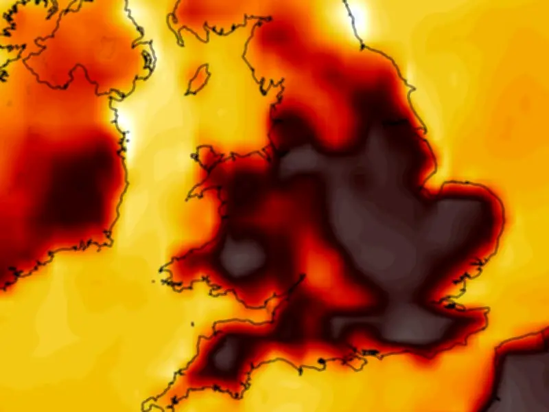
A four-day hot spell looks set to arrive next week, with the GFS weather model showing temperatures climbing above 30C and reaching a peak of 34C in parts of England.
The heat is expected to begin on Wednesday, when highs of 33C are possible in western England, 32C in Wales and 31C in Yorkshire. On Thursday, 34C is possible widely across eastern, central and southern England, with most of England and Wales again above 30C. Friday could see 34C in western areas, while Saturday could bring 34C to the south-east.
Today's forecast
Before that, the Met Office expects temperatures to reach 34C in London later today, with 32C in the Midlands, 29C in the north-west and 27C in Cardiff. Belfast and Glasgow are forecast to see 21C.
Counties set to reach 34C
Temperature anomaly maps for next week shade England and Wales in dark red, indicating conditions well above the seasonal average. The GFS model suggests 15 English counties could see 34C or more next week: Lincolnshire, Nottinghamshire, Leicestershire, Northamptonshire, Cambridgeshire, Norfolk, Staffordshire, Warwickshire, Bedfordshire, Buckinghamshire, Hampshire, Surrey, Kent, Essex and Gloucestershire.
Met Office outlook
The national weather agency says temperatures should remain above average into mid-August, though exceptional heat is unlikely, and there is a risk of thundery interludes in southern areas.
The agency added: "Towards mid August, high pressure may become rather more dominant towards the north of the UK, with lower pressure further to the south. This means there is a greater chance for Atlantic frontal systems or thundery interludes to affect southern areas, certainly in comparison to recent weeks, though rainfall amounts could be quite variable with some areas seeing relatively little. For the most part, temperatures look to remain above average, especially in the south, though perhaps without the exceptional heat we have seen in recent weeks."




