
Major UK Cities Brace for Extended Snow Blizzard This March
Advanced meteorological forecasting maps reveal a significant weather event is poised to impact millions across the United Kingdom. A substantial blizzard, expected to last approximately 28 hours, is forecast to bring substantial snowfall to urban centers as far south as London, with Manchester and other major cities also in its path.
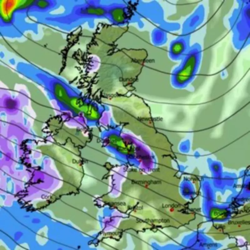
Detailed Timeline of the Approaching Snowstorm
The Global Forecast System (GFS) weather model indicates the initial snowfall will commence around 3:00 AM on March 21. The early stages of the storm will primarily affect western regions, northern areas, and the Midlands. Cities including Belfast, Manchester, and Stoke are projected to experience the first flurries. Meteorological maps suggest the snow will subsequently drift southward, eventually reaching the capital city of London.
By midday on March 21, forecasting visuals show almost the entirety of southern England and Wales shaded in purple, representing active snowfall. A broad corridor of England stretching from Plymouth to Ipswich appears set for significant impact during this period, with London squarely within this zone. The most intense flurries are anticipated to affect South Wales around 6:00 PM, with additional evening snowfall possible in London.

Extended Snowfall and Accumulation Projections
Snow coverage analysis indicates extensive areas across southern England, the Midlands, Wales, northern England, Northern Ireland, and Scotland will have settled snow on the ground by 6:00 AM on March 22. At this time, precipitation is expected to continue across north-eastern England and southern Scotland. The cumulative effect suggests a prolonged weather event with potential for disruption.
Official Meteorological Perspectives and Forecasts
The Met Office has incorporated the possibility of wintry conditions into its longer-range forecasts for the latter part of March. However, the national weather service currently anticipates any snow showers will likely be confined to higher elevations in northern regions. Their official forecast for March 13 to 22 describes a changeable pattern with Atlantic frontal systems bringing occasional rain or showers, most frequent in the west and northwest, potentially accompanied by strong winds.
The forecast notes: "Temperatures will be near-average for the period as a whole, but with some shorter-duration colder interludes at times when frost and hill snow will be possible. Later in the period there may be a transition to more blocked or slower evolving weather patterns, though confidence in the detail of this is rather low."
Similarly, BBC Weather's outlook for March 16 to 22 suggests a slightly cooler overall period with variable daily temperatures as weather systems arrive from the Atlantic. The forecast acknowledges: "It is still early enough in the year for there to be a chance of some wintry showers over higher ground in the north of the UK."
This developing situation underscores the potential for significant late-winter weather across the UK, with major population centers advised to monitor forecasts closely as the predicted dates approach.


