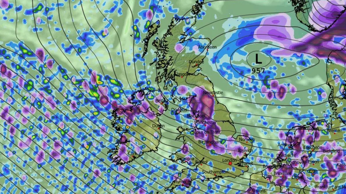
UK Braces for Major Snow Blast: Up to 11 Inches Forecast for Cities
Forecasting maps are indicating a substantial wintry weather blast is poised to sweep across the United Kingdom, potentially burying several major cities under significant snowfall. The ECMWF weather model suggests this blizzard could deliver as much as 11 inches (29cm) of snow in certain areas, with widespread impacts expected on March 8.
Widespread Snowfall Across the Nation
The data reveals that snow will begin affecting Northern Ireland, Wales, the north-west, south-west, and the Midlands from approximately 8am. Cities including Belfast, Manchester, and Liverpool are forecast to be among the first to experience the flurries as the system moves across the country.
By midday, the intensity is predicted to increase dramatically over the Pennines in northern England, with snowfall rates potentially reaching around four inches per hour. This intense period will see the snow spreading southward and eastward, directly impacting Birmingham and reaching into East Anglia.
London and Scotland in the Firing Line
As the blizzard continues its journey south throughout the day, London may encounter snow around 6pm. Simultaneously, Scotland is expected to experience snowfall right across the country from morning through evening.
Maps project snow accumulation across numerous regions including Northern Ireland, the south-west of England, Wales, the Midlands, East Anglia, northern England, and Scotland. The heaviest accumulations are anticipated over hills in Scotland, where up to 29cm could settle.
Detailed Accumulation Predictions
Specific forecasts suggest 10cm (four inches) will accumulate in the North Pennines, with 5cm (two inches) in Wales and 8cm (three inches) in the north-west of England. Most other affected regions will likely see lighter accumulations of 1cm to 2cm.
Contrasting Forecast Perspectives
While these weather maps paint a picture of significant disruption, the BBC Weather forecast for March 2 to 15 offers a more cautious outlook. BBC forecasters currently describe the chance of such wintry conditions as "small".
The BBC forecast states: "Although confidence is even lower than usual for this period, there are some signs of high pressure building near the UK, leading to somewhat drier conditions, with precipitation amounts near or below average."
It continues: "However, the position of this potential high will have a notable influence on both precipitation and wind. It will most likely linger near the UK through the first week of March, bringing relatively dry conditions, along with a risk of frost and fog."
The forecast adds that daytime temperatures should be at least near seasonal for most areas, and potentially above average, although chillier conditions are possible across Scotland. "There is a small chance that high pressure could develop at higher latitudes, which would bring a risk of a colder week, though strong cold anomalies would not be expected. Wintry showers would then become more likely."
This divergence in predictions highlights the uncertainty typical of longer-range weather forecasting, leaving the UK to prepare for potential significant snowfall while acknowledging alternative scenarios of drier conditions.


