
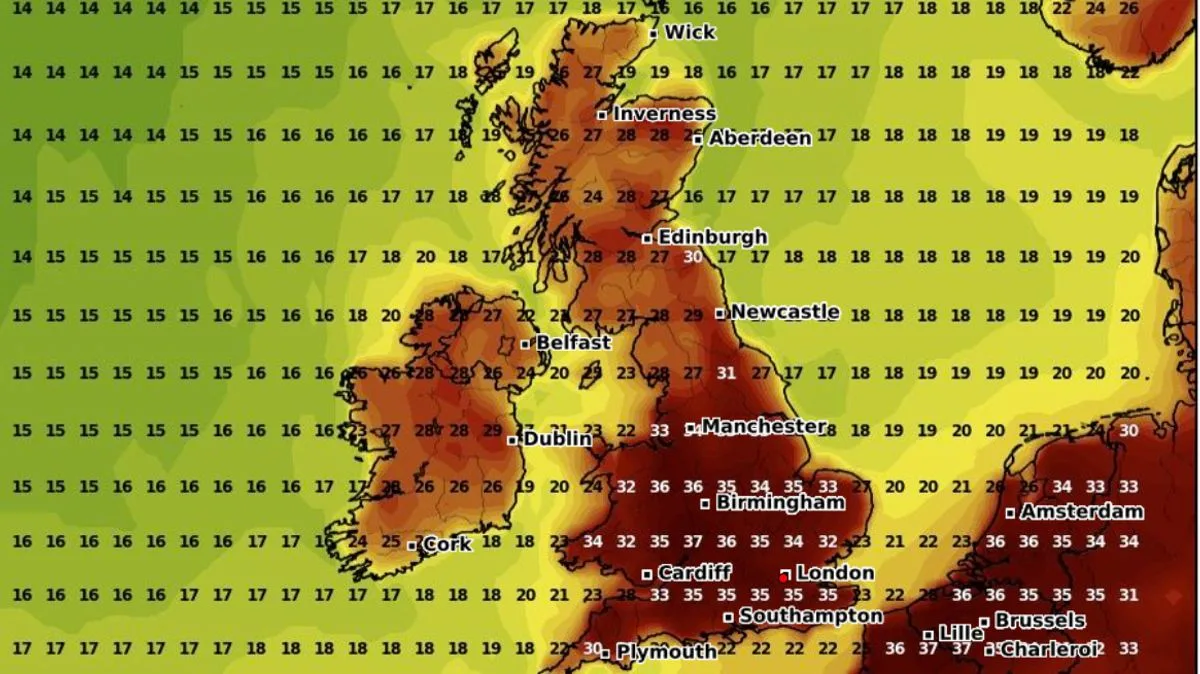
Four parts of the UK are set to bear the brunt of a stifling 37C scorcher which is set to bake the British Isles in a matter of days. After weeks of unseasonable rain, thunderstorms and blustery conditions, the mercury is expected to soar next week as weather maps turn an angry red.
New maps from WXCharts, which uses MetDesk data, show the blanket of heat descending on the UK around Saturday, August 16, reaching its peak the following day. The four areas set to be hit hardest are Gloucestershire, Warwickshire, Worcestershire and North Wales, where temperatures are expected to surge to a searing 37C.
If these temperatures are reached, it would make it the warmest day on record since the record-smashing 40C logged during the infamous 2022 heatwave. Other areas will not be far behind, with highs of 36C forecast for Oxfordshire, Berkshire, Hampshire and the West Midlands. The whole of southern England will see highs of 35C, as will south Wales.
Conditions will be slightly more manageable in southwest England, where cities like Bristol and Bath could see highs of 33C. The East Midlands will see similar highs. The rest of Wales is likely to see temperatures of around 32C. Parts of Yorkshire and the Humber could see the mercury teeter around 33C. However, further north into Scotland and Northern Ireland, the conditions will be noticeably cooler with highs in the low to mid 20s.
The Met Office's long-range weather forecast for the UK indicates that towards the middle of August, there is an increased chance of high pressure becoming more dominant, leading to drier, warmer and more settled conditions becoming more widespread. High pressure, and therefore fairly settled conditions overall, appears most likely for the second half of August, though the northwest may see more in the way of occasional rain or showers than other areas.




