
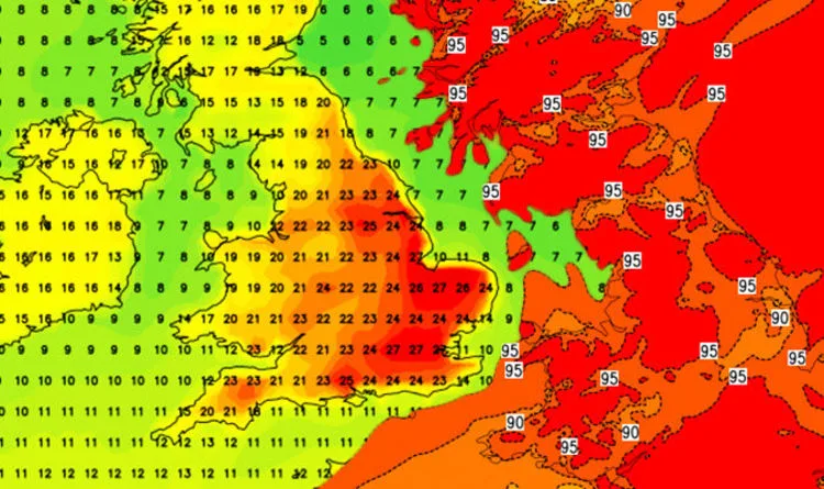
Britain is set to bask in unseasonably warm weather this week, with temperatures expected to reach 28C (82.4F) in parts of the southeast by Thursday. The warm spell is being driven by a 2,000-mile wide low-pressure vortex named 'Irene' that is pulling tropical air from the Azores towards the UK.
However, before the heat arrives, parts of western Britain will experience strong winds and heavy rain. The Met Office has issued a weather warning for rain across southwest Scotland, the Lothian Borders, and Strathclyde, with up to two inches of rain expected in some areas. Gusts of nearly 60mph are possible along western coasts.
Meteorologist John West explained that the low-pressure system, which underwent explosive cyclogenesis, is the most powerful to form in the Atlantic at this time of year since 2013. He said: 'This is such a big area of low pressure that it is actually drawing warm air up from the tropics and bringing it into the UK.'
By mid-week, high pressure building over France and western Germany will create a 'conveyor belt' for warm air to sweep across the UK. Eastern and southern England will see the best of the sunshine, with temperatures hitting 25C (77F) on Thursday. The warm conditions are expected to persist through the weekend, though temperatures may drop slightly.
The London Marathon on Sunday could be affected, with temperatures possibly reaching 20C (68F) in the capital, making conditions challenging for runners. Bookmaker Ladbrokes is offering odds of 4-7 on the mercury reaching 25C (77F) anywhere in the country over the next week.




