
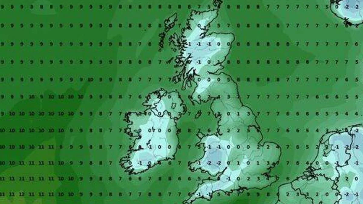
Britons are being warned to brace for a burst of wintry weather as weather maps show temperatures plummeting to -2C in parts of the UK. The cold snap is expected to grip much of the country by mid-November, with freezing early mornings and widespread frost reaching as far south as Cornwall.
According to the latest WXCharts map, central and western Wales will face the coldest weather, with early morning temperatures potentially falling to -2C around 6am. Bath is predicted to experience similarly freezing conditions, while the Midlands will hover around 0C. Even the south coast will not be spared, with Southampton expected to see around 0C, and Devon, Plymouth, and Cornwall all forecast to dip to around -1C.
The Met Office's long-range forecast for November 8 to 18 indicates a transition to less unsettled weather from around November 11 or 12, with drier conditions becoming more common and winds turning south easterly or easterly. Temperatures are expected to be around average overall, but the cold snap will persist through the weekend.
WX Charts also predicts that temperatures will remain below zero at noon on Saturday, November 15. The UK's coldest November on record occurred in 1919, when the average temperature was just 2.3C, and Braemar in Aberdeenshire recorded a staggering -23.3C on November 14, 1919, the lowest daily minimum temperature ever recorded in the UK for November.




