
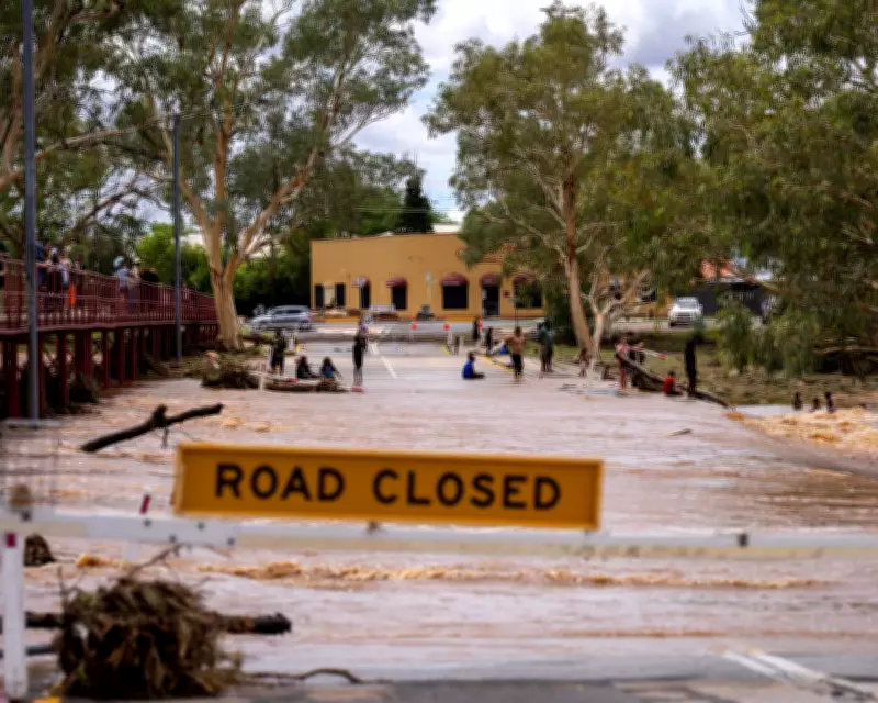
A significant weather event is unfolding across Australia's east coast, driven by a humid and unstable air mass that is expected to bring widespread rain, potential flooding, and thunderstorms. Meteorologists have issued warnings for severe conditions, urging residents to stay alert and prepared.
Weather Patterns and Forecast
The humid and unstable air mass is moving across the region, creating conditions conducive to heavy precipitation. Forecast models indicate that this system will persist for several days, leading to prolonged periods of rain and increased risk of flooding in low-lying areas.
Impact on Coastal Regions
Coastal communities along the east coast are particularly vulnerable, with predictions of intense rainfall and thunderstorms. Authorities are monitoring river levels and have activated emergency response plans to mitigate potential damage from flash floods.

Residents are advised to secure outdoor items, avoid unnecessary travel, and stay informed through official weather updates. The unstable air mass may also trigger isolated severe thunderstorms, bringing strong winds and hail in some areas.
Long-Term Outlook
While the immediate focus is on the east coast, the weather system could influence broader regions. Meteorologists are tracking its movement closely, with updates expected as conditions evolve. This event highlights the importance of climate resilience and preparedness in the face of increasingly volatile weather patterns.


