
Northeast Blizzard Hits 'Goldilocks' Sweet Spot for Record Snow Totals
A powerful nor'easter smacking much of the Northeast with nearly three feet of snow in some areas is being described by meteorologists as a classic, record-setting blizzard. This intense winter storm, the strongest in a decade and comparable to historic events, rapidly intensified into a "bomb cyclone" and featured rare phenomena like thundersnow and lightning.
Perfect Conditions for Maximum Snowfall
Meteorologists highlight that the storm hit a "Goldilocks situation" with ideal temperature and moisture conditions. Owen Shieh, warning coordination meteorologist at the National Weather Service's Weather Prediction Center in Maryland, explained that any warmer and precipitation would not have fallen as snow; any colder and there would have been insufficient atmospheric moisture to feed the heavy snowfall.
Jeff Masters, co-founder of Weather Underground and meteorologist at Yale Climate Connections, noted the storm followed the perfect track for maximum impact. A slight shift inland would have reduced its energy from warm ocean air, while moving farther out to sea would have dumped the heaviest snow over water instead of populated areas.

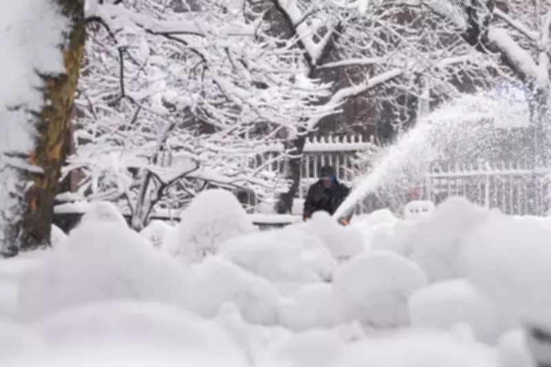
Record-Breaking Snow Accumulations
Preliminary reports show staggering snow totals across the region. Providence set an all-time record with 32.8 inches, surpassing the 1978 benchmark, while Islip Airport in Long Island recorded 26.5 inches. Freehold, New Jersey, saw 24.2 inches, and Southampton, New York, had 24 inches, all before noon on Monday with snow still falling.
New York City accumulated over 15 inches, and Philadelphia exceeded 13 inches, according to National Weather Service calculations. Shieh warned that the wet, heavy snow poses risks, particularly for heart attacks during shoveling, urging residents to take frequent breaks.
Intense Storm Development and Features
The storm intensified rapidly, dropping 39 millibars in 24 hours—easily qualifying as "bombogenesis" or a "bomb cyclone." Ryan Maue, a private meteorologist and former NOAA chief scientist, called it a "superbomb" with a pressure of 966 millibars, equivalent to a Category 2 hurricane if tropical. He described it as "a hurricane with snow."
Louis Uccellini, former weather service director, compared it to historic storms from 2016 and 1961, noting its classic intensity in both snowfall rates and storm power. A recent study suggests that in a warming world, the strongest nor'easters are becoming significantly stronger, with factors like a stretched polar vortex contributing to this event.
Rare Thundersnow and Lightning
An unusual combination of winter and summer weather—thundersnow and lightning—added to the storm's intensity, thrilling meteorologists. Jim Cantore of The Weather Channel reported live from Plymouth, Massachusetts, when lightning struck nearby, echoing a similar event 11 years ago. Matthew Cappucci, a meteorologist from Plymouth, marveled at lightning strikes hitting a New York City skyscraper and wind turbines off the Massachusetts coast.
Meteorological Admiration and Warnings
Experts like Cappucci, Judah Cohen of MIT, and Uccellini praised the storm's perfect alignment of features, visible in satellite images that resembled computer-generated imagery from a disaster movie. Shieh remarked on its almost surreal appearance, emphasizing the danger it poses despite its beauty.
As the blizzard continues to impact millions along the Eastern Seaboard, meteorologists urge caution, highlighting the storm's paralyzing potential and the need for safety measures during cleanup efforts.


