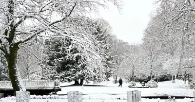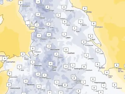
Wales is set to experience snow, heavy rain and strong winds in the coming weeks as winter conditions take hold, according to the Met Office. Temperatures have already fallen below freezing in parts of the country, and further wintry weather is expected to move in from Monday evening.
Snow Forecast for Early Week
A weather front arriving from the south-west is expected to bring snow from around 3pm on Monday, with further snow forecast on Tuesday in Gwynedd, Conwy, Denbighshire, Flintshire, Wrexham, and Powys. Some areas could see snow in the coming days, including north Wales, Aberystwyth, and areas north of Swansea.
BBC weather forecaster Helen Willetts said: "Tuesday looks quite an interesting day as we've got this next weather system running to the south of the UK, as it comes and bumps into the cold air we could have a spell of snow. We are staying in the colder air for much of next week."
Unsettled Conditions Through Late November
Saturday night is expected to freeze again in parts, while Sunday is forecast to bring bright spells alongside the potential for heavy and thundery rain showers. As late November approaches, rain and wind are expected to return.
According to the Met Office, the forecast between November 18 and November 27 states: "A changeable and often rather unsettled period looks most likely. Further areas of low pressure will move in from the Atlantic and whilst all parts are likely to see some rain at times, it is southern areas which may turn out to be wettest, relative to average conditions, through this period. Strong winds are also possible from time to time. Incursions of milder air are likely towards the south, but it could remain on the cold side overall further to the north, where there is potential for sharp overnight frosts where clear skies and light winds combine."
Longer Range Outlook into December
For the period between November 28 and December 12, the Met Office forecasts: "Low pressure is signalled become slow moving to the west then south of the UK, whilst pressure builds to the north of the country. Further rain is probable across southern and perhaps central areas, but below average precipitation could occur in parts of the north, especially the northwest."
The forecast adds: "With a blocked weather pattern signalled to develop, this increases the chance of colder conditions overall, with associated winter hazards, e.g. snow and ice, occurring; this most likely further to the north."