Met Office Warns of Heavy Snow and Icy Conditions Across UK
The United Kingdom is bracing for a severe Arctic blast, with temperatures forecast to plummet to as low as -3 degrees Celsius over the coming days. The Met Office has issued a yellow warning for snow and ice, covering significant portions of the country, as a cold front moves in from the northwest.
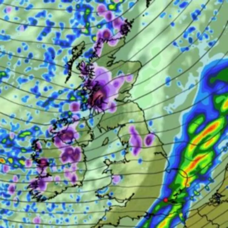
Widespread Snowfall and Disruption Expected
Weather maps indicate that the worst-affected areas will be in the north, particularly western Scotland, where up to 17 centimetres of snow could accumulate by Friday. Flurries are also anticipated in the northwest of England and Wales, adding to the wintry conditions. The Met Office warning for central Scotland is active from midnight until 9 am on Friday morning, highlighting the risk of blustery wintry showers that may intensify overnight.
According to the national weather agency, "2-5 cm of snow is expected fairly widely across the area, with 10 cm possible in places above about 350 metres." This follows a week of heavy rain and ferocious winds that have already battered the UK, with low-pressure systems now driving the temperature drop.

Travel Advisory and Safety Precautions
Residents in the affected regions are urged to prepare for potential travel disruptions. The Met Office advises carrying essentials in vehicles, such as warm clothing, food, water, blankets, torches, ice scrapers, and phone chargers, to ensure safety during delays. Driving conditions may become hazardous due to snowy and icy roads, so planning routes and allowing extra time for journeys is recommended.
The agency states, "Snowy, wintry weather can cause delays and make driving conditions dangerous. Keep yourself and others safe by planning your route, giving yourself extra time for your journey."
Weather Forecast and Longer Outlook
Overnight predictions include heavy rain clearing southeast across England and Wales, with clear spells and wintry showers elsewhere. Persistent rain and snow are likely over high ground in Scotland, accompanied by patchy frost and ice. Winds are expected to be strong but gradually ease.
For Friday, the forecast calls for a cold and windy day with a mix of sunshine and blustery showers, potentially merging into more persistent rain and snow, especially over northern hills. The cold snap is projected to persist into the weekend before temperatures begin to rise next week.
Looking further ahead, from March 17 to 26, the Met Office suggests a period of more settled weather for much of the UK, with possible overnight frost and fog but pleasant spring sunshine by day. However, uncertainty remains about how long these conditions will last, with showers or rain potentially returning later in the period, particularly in the south.