
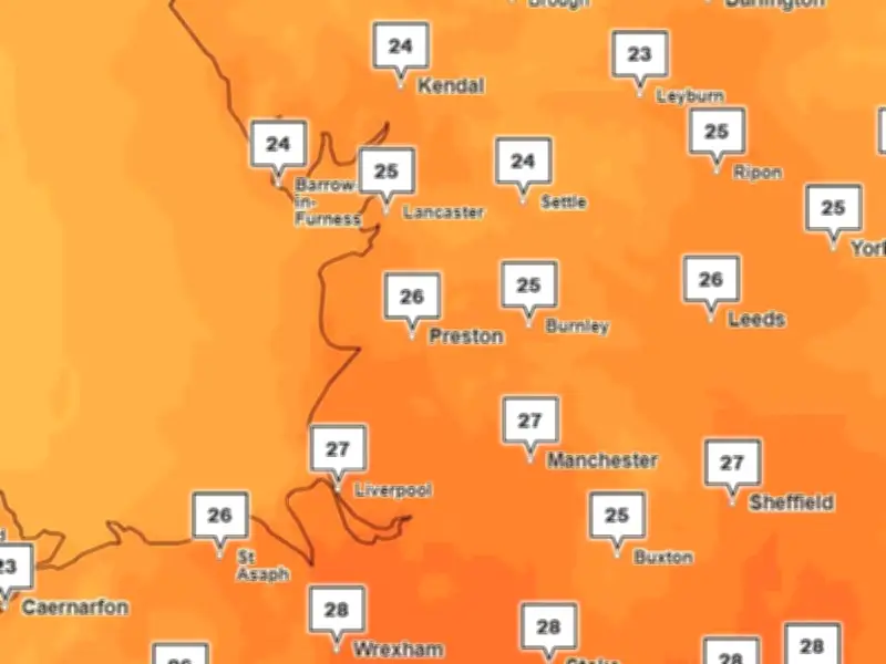
Following a prolonged period of hot and dry weather, the Met Office has forecast more heat for Greater Manchester next week, with the latest maps showing temperatures peaking at around 27C during late afternoon on Monday.
After another dry week, the Met Office has forecast a cloudy start to Saturday (August 1) for the North West of England, with a few showers early on. Conditions will turn drier this afternoon with some warm sunny spells. Top temperatures in Greater Manchester will be around 18C to 19C by late afternoon.
Tonight will be largely dry with clear spells, which could feel chillier than of late. Average temperatures in Greater Manchester will be around 9C.
Sunday and next week
Sunday will start warm and dry, with "plenty of sunny spells and light winds," according to the Met Office. Things will become cloudier as the day goes on with "some outbreaks of rain". Top temperatures in Greater Manchester will be around 22C to 24C.
Looking into next week, the Met Office outlook for Monday to Wednesday says conditions will turn "very warm and humid" from Monday, but with an increasing chance of showers. There will also be a small risk of thunderstorms at times. The latest Met Office weather maps show temperatures around Greater Manchester peaking at around 27C during late afternoon on Monday.
UK long range forecast
The UK long range forecast from Wednesday, August 5, to Friday, August 14, predicts a more changeable period. The Met Office says: "Many places likely to see some much needed rain or showers at times but also some more sunshine." Initially, some rain or showers will affect many parts, this heavy and possibly thundery in places.
After a drier, brighter few days, further changeable or unsettled conditions may develop as we head towards mid-August. The Met Office says: "This may be due to frontal systems moving in from the Atlantic or thundery plumes moving north from the continent or a combination of both."
Temperatures will likely be a little above average overall, and there is the potential for some very warm or hot and humid spells, especially in the south, although perhaps not the heat we have seen in recent weeks.




