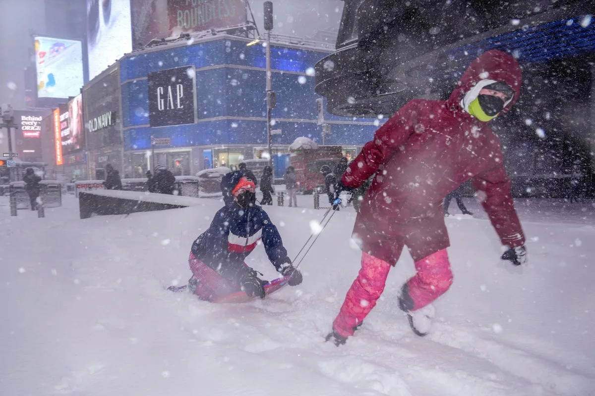
Winter Storm Hernando: Northeast Braces for Historic Blizzard and Bomb Cyclone
Historic Blizzard and Bomb Cyclone to Hit Northeast US

Winter Storm Hernando Threatens Northeast with Historic Blizzard Conditions

Millions of residents across the northeastern United States are preparing for a severe and potentially historic winter storm, with Winter Storm Hernando forecast to deliver blizzard conditions, heavy snowfall, and powerful winds across the region within hours. The storm system is expected to span the entire Northeast Corridor from Sunday onwards, creating hazardous travel conditions and significant disruptions.

Widespread Impact and Severe Weather Warnings

Approximately 50 million people are under threat from this major weather event, with predictions of snowfall accumulations reaching up to two feet in some areas. Wind gusts are anticipated to hit speeds of 70 miles per hour, exacerbating the dangerous conditions. Officials have issued stark warnings, indicating that travel could become dangerous, if not impossible, due to the combination of heavy snow and high winds.

Power outages and downed tree limbs are highly likely as the storm intensifies. States including Delaware, New Jersey, Connecticut, Rhode Island, New York, and Pennsylvania have been alerted to brace for arctic-like conditions, with residents advised to take necessary precautions.

Wide Pickt banner — collaborative shopping lists app for Telegram, phone mockup with grocery list

Major Travel Disruptions and Flight Cancellations

The impending storm has already led to substantial travel chaos, with more than 3,000 flights canceled for Sunday and Monday. The majority of these cancellations are concentrated around major hubs such as Boston and New York City, affecting numerous carriers. According to Fox Weather, this number is expected to rise significantly as the snowfall begins.

Regional airports are anticipating widespread delays and further cancellations, particularly as blizzard conditions set in. Travelers are being urged to check with their airlines and consider postponing non-essential trips.

New York City Braces for First Blizzard Since 2017

New York City is preparing for its first blizzard since March 2017, with a blizzard warning scheduled to take effect from noon on Sunday. Meteorologist Owen Shieh, speaking to the Wall Street Journal, noted that the city has lucked out in the last decade regarding severe winter storms. He issued a stern warning to residents, stating, You don't want to be outside. You won't be able to see in front of you.

The National Weather Service predicts that New York City could receive between 13 to 18 inches of snow, with potential for even higher accumulations. During the last significant blizzard in 2017, the city experienced over a foot of snow and wind gusts up to 60mph.

State of Emergency Declarations and Government Response

In response to the severe forecast, several states and cities have declared states of emergency. New Jersey Governor Mikie Sherrill announced a state of emergency starting at noon on Sunday, describing the storm as severe. Similarly, New York Governor Kathy Hochul has declared a state of emergency for New York City, Long Island, and parts of the Hudson Valley.

Local authorities are mobilizing resources to manage the storm's impact. New York City Mayor Zohran Mamdani has urged residents to stay off the roads unless absolutely necessary, emphasizing, If you can stay home, stay home. The city plans to deploy 2,200 snow plows, along with hundreds of shovelers and additional personnel, to combat snow accumulation.

Storm Progression and Meteorological Details

Winter Storm Hernando is expected to follow a specific path, initially affecting Washington DC and Philadelphia before moving northward to New York City. Snowfall is forecast to begin as early as 7am on Sunday in some areas, with the heaviest accumulations in New York City likely from 7pm Sunday until noon Monday.

Forecasters predict that the storm system will undergo rapid intensification, forming what is known as a bomb cyclone or Arctic hurricane. This phenomenon occurs when the system's pressure drops sharply, leading to extremely powerful winds and heavy precipitation. It is important to note that while the US experienced an intense winter storm in January, true blizzard conditions require wind speeds above 35mph, which this storm is expected to exceed.

Pickt after-article banner — collaborative shopping lists app with family illustration

Regional Specific Impacts and Future Outlook

Southern Delaware and the Jersey Shore are anticipated to face blizzard conditions starting on Sunday, with snow accumulations potentially reaching 24 inches according to CBS reports. In Delaware, residents have been encouraged to travel only for emergencies, and some Pennsylvania counties have also issued state of emergency warnings.

Boston is bracing for its first major snowstorm since 2022, with conditions expected to persist through 7am on Tuesday. Despite the immediate severe weather, there is a silver lining: temperatures are forecast to rise into the 40s Fahrenheit by midweek across most affected areas. This warming trend should facilitate the melting of snow accumulated on sidewalks and roads, aiding recovery efforts.

As Winter Storm Hernando approaches, residents throughout the Northeast are urged to stay informed through official weather updates, prepare emergency kits, and avoid unnecessary travel to ensure safety during this significant weather event.