
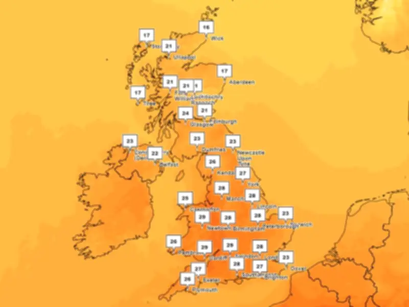
Greater Manchester is set to experience another heatwave next week, with temperatures forecast to reach highs of 30C. The UK Health Security Agency (UKHSA) has issued a yellow heat-health alert affecting most of England between Saturday (August 8) and Tuesday (August 11).
Heat-health alert in force
The alert covers the East Midlands, East of England, London, South East, South West, West Midlands, and Yorkshire and The Humber. Further warnings could be issued as temperatures are expected to remain high after Tuesday.
Heatwave definition and forecast
A heatwave is defined as three consecutive days at a certain temperature, with the threshold for north west England set at 25C. In Greater Manchester, a heatwave is forecast for Tuesday, Wednesday, and Thursday, with temperatures peaking at 28C, 30C, and 25C respectively.
Confidence in how long the heat will last is not high, but Met Office temperature maps suggest a cool-down after Thursday, potentially ending the three-day heatwave.
Met Office outlook
A Met Office spokesperson said: "Current forecasts suggest that temperatures will build through the first half of next week, peaking around Tuesday and Wednesday. Beyond that, confidence naturally reduces, but at present the warm conditions look capable of continuing into the latter part of the week."
The long-range forecast for the UK, covering August 11 to 20, mentions spells of rain, strong winds, and 'very warm or hot' periods. It states: "A settled start, with mainly dry conditions on Tuesday, although with scattered showers across western areas. Then through the week, more changeable conditions are likely across northern parts, with some spells of rain or showers and stronger winds, interspersed by drier periods. Whilst southern areas will generally see more settled, drier conditions where it will become very warm or hot."
Further into August, lower pressure may track further south or east, increasing the chance of frontal systems or thundery interludes in southern and eastern areas. Rainfall amounts could be variable, with some areas seeing relatively little, but temperatures are expected to remain above average, especially in the south.




