
UK Braces for Four-Inch Snow Blizzard: Maps Reveal Widespread Impact
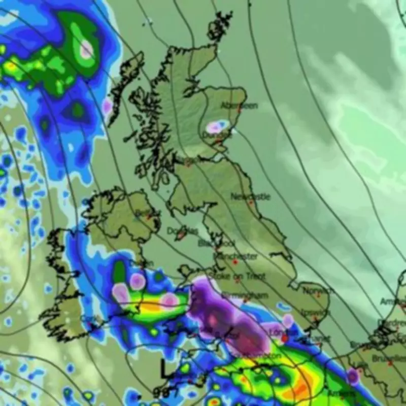
Weather forecasting maps have revealed that a significant snowstorm is set to sweep across the United Kingdom, with up to four inches of snow expected to settle in some areas within the next 48 hours. The ECMWF weather model indicates that a blizzard will move in from the Atlantic, initially bringing rain to the south coast of England while snow falls over Wales, the Midlands, and southern-central regions.
Initial Impact and Spread
Data suggests that both Birmingham and London could experience flurries during the initial phase of the storm on Wednesday evening. As the system progresses, it is forecast to spread eastward, with maps showing a band of snow extending from North Wales down to the south-east of England by 9pm on Wednesday. Cities such as Bristol and Stoke-on-Trent are likely to see snowfall at this time, with continued flurries in Birmingham and London.
Snowfall Accumulations and Timing
Maps project that snow will still be falling in London around 3am on Thursday morning, with the East and West Midlands also heavily affected. Flurries are expected to reach into East Anglia as well. In terms of accumulation, the Cotswolds could see up to 11cm (approximately four inches) of snow settling, while parts of South Wales may receive as much as 10cm. The West Midlands could see 8cm (three inches), the East Midlands 5cm (two inches), and London around 1cm, although areas just north of the city might experience up to 5cm.

Met Office Forecast and Outlook
According to the Met Office, the weather is expected to remain changeable as we approach March, with further spells of wet and windy conditions interspersed with brighter, showery periods. Some colder conditions could develop, particularly in the north, but there are signs that high pressure may dominate later, leading to drier weather. The forecast for February 21 to March 2 states: "Remaining changeable to begin with, as Atlantic low pressure systems push east over or to the north of the UK. This means further spells of wet and at times windy weather, interspersed with brighter, showery interludes. Some heavy rain is likely, especially across high ground areas in the west and north, though some sheltered eastern and southern parts may see comparatively little rain. It will likely be relatively mild overall, though some occasional colder spells are possible, particularly in the north. Around the turn of the month, there is a signal that high pressure will become more dominant, meaning more in the way of dry weather developing."


