Historic Nor'easter Paralyzes East Coast with Massive Snowfall and Travel Chaos
A powerful winter storm system is currently battering the East Coast of the United States, triggering widespread blizzard alerts and creating severe travel disruption. Forecasters from the National Weather Service (NWS) have issued urgent warnings for a major nor'easter expected to bring up to 18 inches of snow and dangerous conditions from Maryland through to Massachusetts.
Widespread Blizzard Alerts and Severe Weather Predictions
Blizzard warnings remain in effect across numerous major metropolitan areas, including New York City, Long Island, Boston, and coastal communities throughout New Jersey, Connecticut, Delaware, Maryland, Rhode Island, and Massachusetts. The NWS predicts substantial snowfall accumulations ranging between 1 to 2 feet (30 to 61 centimeters) across many regions, with accompanying risks of coastal flooding in parts of New York and New Jersey.
Cody Snell, a meteorologist at the NWS Weather Prediction Center, emphasized the unusual scale of this impending weather event. "While we do get plenty of these nor'easters that produce heavy snow and strong impacts, it's been several years since we saw one of this magnitude across this large of a region in this very populated part of the country," he stated, highlighting the significant threat posed to densely populated areas.

Massive Air Travel Disruption and Grounded Flights
The aviation sector is experiencing severe disruption, with major carriers including Delta, American, and United proactively grounding flights in the New York City area and at Boston's Logan International Airport. Preliminary data from FlightAware indicates that JetBlue alone has cancelled 40% of its Sunday flight schedule in anticipation of the storm.
Overall, more than 3,000 flights have been cancelled and at least 12,000 flights delayed across New York's major airports as this historic blizzard threatens to bury the region under at least two feet of snow. With perilous conditions expected to intensify throughout Sunday, several major airlines grounded flights on Saturday at key transportation hubs including JFK, LaGuardia, Newark, and airports in Philadelphia and Boston. Aviation experts warn these numbers are expected to increase dramatically once heavy snowfall begins.
Storm Evolution and Dangerous Conditions Forecast
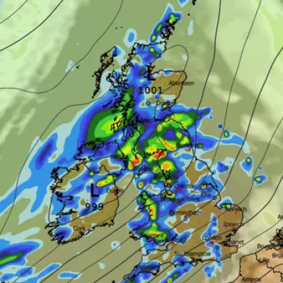
The storm is anticipated to begin as rainfall in some locations before rapidly worsening, with the heaviest snowfall projected for overnight Sunday into Monday morning. Some areas could experience intense snowfall rates of up to 2 inches (5 centimeters) per hour before conditions gradually ease by Monday afternoon. Accompanying wind gusts reaching 55 mph (80 kph) are expected to create whiteout conditions that "will make travel treacherous and potentially life-threatening," according to weather officials.
The dangerous combination of strong winds and heavy, wet snow also raises significant concerns about downed power lines and widespread electrical outages across affected regions. This storm's arrival coincides with the final melting of icy remnants from a previous snowstorm that had impacted the same areas.
Emergency Preparations and Official Responses
Municipal officials have been scrambling to adjust their emergency preparations as forecast models changed rapidly. New York Mayor Zohran Mamdani acknowledged the dramatic shift in predictions, stating: "We saw on Friday there was expectation that the likelihood was that we were going to face maybe 3 to 4 inches of snow. Quickly that then changed. So we want to make sure that we make a decision based on up-to-date and accurate information." The city has consequently expanded its snow-clearing operations, deploying additional equipment and utilizing geocoding technology to manage critical infrastructure like bus stops and crosswalks.

In Atlantic City, New Jersey, officials have issued urgent appeals for residents and casino visitors to avoid streets, particularly in low-lying areas susceptible to flooding. Scott Evans, the city's fire chief and emergency management coordinator, provided a stark warning: "I could go on and on probably with a good two dozen streets where we know we will get water and there will be snow on top of that. So you won't be able to see it until it's too late. So therefore please stay at home."
Business and Community Impacts
The impending storm has prompted extensive operational preparations from businesses and service providers. John Berlingieri, who operates Berrington Snow Management on Long Island, cancelled a family trip to Puerto Rico to prepare his company for what he described as a "mammoth task" of clearing millions of square feet of asphalt. His employees spent days recharging equipment and replacing components, with Berlingieri anticipating "at least one week of work around the clock. We're going to work 24 to 36 hours straight, sleep for a few hours and then go back."
Across the region, many community activities have been cancelled or adjusted. Numerous churches have cancelled Sunday services, with some like St. Veronica Parish in Howell, New Jersey, adding extra Mass services on Saturday evening. The Rev. Peter James Alindogan posted online messages urging parishioners: "Please stay safe, avoid unnecessary travel, and keep one another in prayer during the storm."