
Tropical Cyclone Narelle has torn through remote parts of Queensland, bringing wind gusts of up to 270km/h and causing significant damage to buildings and infrastructure. The storm, which formed in the Coral Sea just two days ago, made landfall in Cape York on Friday morning, affecting small communities such as Archer River and Lockhart River.
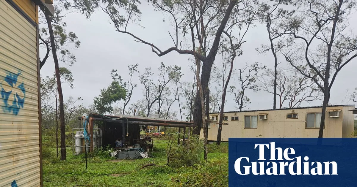
Residents took extraordinary measures to protect themselves. Debbie Jackson and her family sheltered in shipping containers overnight as the cyclone approached their cattle station. Debbie Cameron, manager of the Archer River roadhouse, described the scene as 'devastation', with crushed buildings and downed sheds. 'I don't think there's a leaf left on any tree,' she said.
In Lockhart River, a community of about 700 people, powerlines fell, trees were uprooted, and debris scattered across the area. The local airstrip sustained damage and will require repairs before flights can resume. Despite the destruction, Shire Council CEO David Clarke noted that the community was 'relatively unscathed' due to two days of preparation and their experience with cyclones. 'All of our folks are cyclone-hardened from birth,' he said.

The storm was initially forecast to hit the town of Coen as a category 5 system, but it veered north, sparing the town. Queensland Premier David Crisafulli said the cyclone 'threaded the needle between both' Coen and Lockhart River. He reported no injuries as of Friday afternoon, calling it 'an incredibly good news story' given the potential for disaster.
Record ocean temperatures fueled the cyclone, which reached category 5 intensity offshore before weakening slightly to a category 4 at landfall. Sustained winds of 195km/h were recorded, just short of the highest category. The last major cyclone to hit the area, Tropical Cyclone Mahina in 1899, claimed 307 lives.


