Entertainment
Repair Shop's Dom Chinea Overwhelmed by Workshop Weather Damage in Finale
Dom Chinea from The Repair Shop faced emotional turmoil as heavy rain ruined his tools and workshop in the last episode of his Cornish series, testing his resilience.
Politics
Trump Dismisses War Crime Concerns Over Iran Infrastructure Bombing Threats
US President Donald Trump states he is 'not at all' worried about committing war crimes by threatening to bomb Iranian civilian energy facilities, drawing condemnation from politicians and UN officials.
Sports
Harry Maguire Extends Manchester United Contract with New One-Year Deal
Manchester United defender Harry Maguire has signed a one-year contract extension with an option for a further year, expressing confidence in the club's future success.
Crime
Mother Missing for 42 Years After Childbirth Found Alive in Texas
Lula Ann Gillespie-Miller vanished in 1974 after giving birth and was presumed dead. Her daughter tracked her down 42 years later, discovering she had been living under an alias in Texas.
Business
Health
Weather
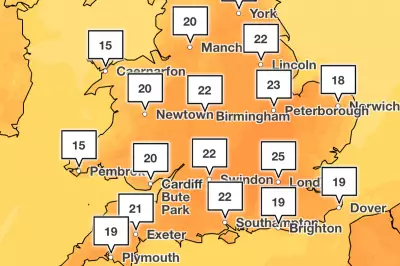
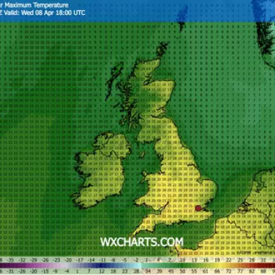
UK April Heatwave: 25C Temperatures Forecast This Week
Met Office forecasts temperatures up to 25C across the UK this week, potentially making it the warmest April in six years. London expected to peak at 25C on Wednesday before cooler conditions return.
Hay Fever Make-Up Survival: Expert Tips for Pollen Season
Make-up artist Ariane Young and skincare expert Dr Amiee Vyas reveal five strategies to combat redness and irritation during the Met Office's red pollen alert across the UK.
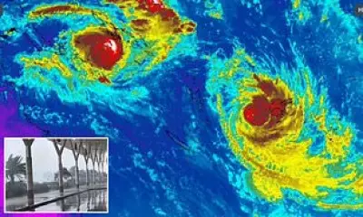
Twin Cyclones Disrupt Pacific Travel: Fiji, PNG, Queensland Alert
Australians travelling in Fiji and Papua New Guinea face disruptions as Cyclones Maila and Vaianu bring severe weather, with warnings for strong winds, flooding, and transport delays.
UK Hay Fever Red Alert Issued for Week-Long High Pollen
The Met Office has declared a red hay fever alert, forecasting very high pollen levels across most of the UK, affecting millions with symptoms like sneezing and itchy eyes.
UK Mini Heatwave: Three Days of 22C Temperatures Forecast
Britain is set to sizzle in a three-day mini heatwave from Wednesday, with temperatures climbing to 22C in some regions before cooling off ahead of the weekend.
Tech
Get Updates
Subscribe to our newsletter to receive the latest updates in your inbox!
We hate spammers and never send spam
Environment
Monday Sports Challenge: Football, Cricket & Rugby Questions
Start your week with our Monday sports quiz featuring 100 questions about British football, cricket, and rugby. How well do you know these popular UK sports?


