
The Met Office has significantly widened the scope of a severe weather alert, placing 47 areas across England under a yellow rain warning for Thursday, 15th January 2026. Residents are being advised to prepare emergency kits in anticipation of potential flooding and disruption.
Expanded Warning and Immediate Risks
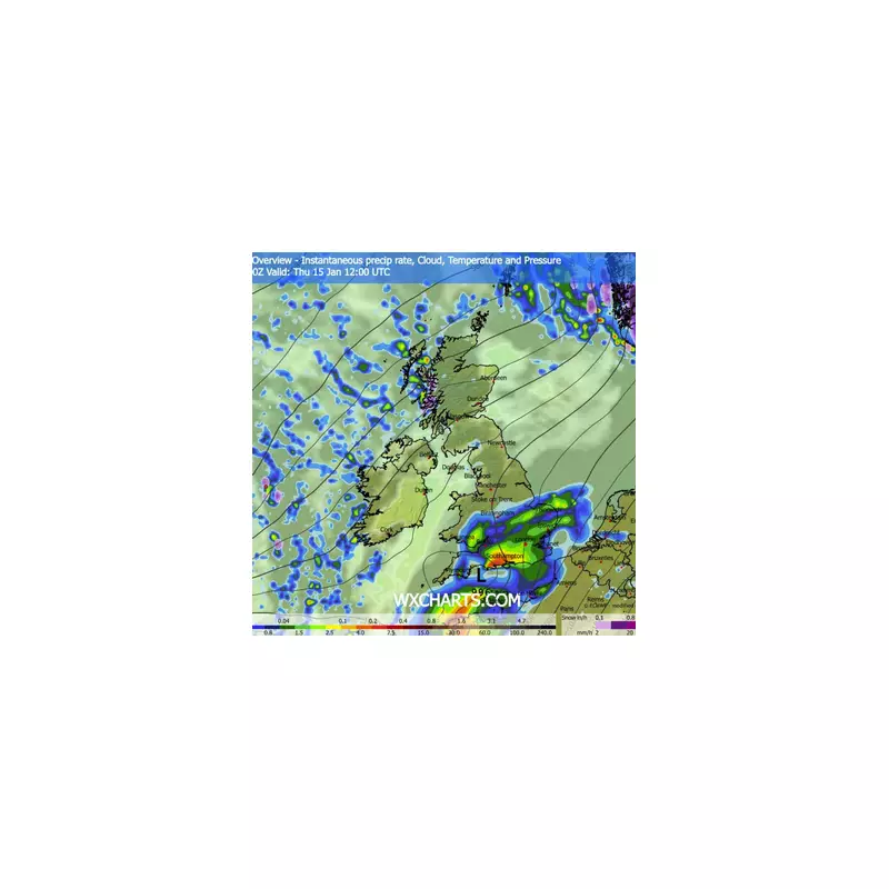
The warning is now in force from 9am until 10pm, a period of 13 hours. Initially covering parts of the South East and South West, the alert has been extended to include sections of East England and the Midlands. The forecaster states that outbreaks of rain will move northeast across England and Wales, turning "persistent and heavy" at times before easing later in the evening.
Key risks associated with this weather system include:

- Flooding of homes and businesses.
- Disruptions to bus and train services.
- Longer journey times due to spray and flooding on roads.
- Possible power cuts.
Urgent Public Advice: Prepare Your Emergency Kit
In response to the forecast, the Met Office is urging people in the affected regions to take immediate precautions. The public is strongly advised to check if their property is at risk of flooding. Those in vulnerable locations should consider activating a flood plan and assembling an emergency flood kit.
To prepare for potential power outages, households are recommended to gather essential items such as torches, batteries, and a fully charged mobile phone power pack. The emphasis is on being ready for possible isolation or loss of services for several hours.
Expected Rainfall Totals and Further Disruption
Widespread rainfall accumulations of 20mm to 30mm are predicted, with some areas receiving this amount within just a few hours. The Met Office has indicated that a few isolated spots, particularly in southern England, could see totals as high as 50mm.
"Heavy rain falling on saturated ground may lead to some surface water flooding on Thursday," a Met Office spokesperson stated. Adding to the disruption, strong winds are expected later, with gusts of up to 50mph possible along exposed coasts in southern and southeastern England.
The following areas are covered by the yellow warning:
East Midlands: Leicester, Leicestershire, Lincolnshire, Northamptonshire, Rutland.
East of England: Bedford, Cambridgeshire, Central Bedfordshire, Essex, Hertfordshire, Luton, Norfolk, Peterborough, Suffolk.
London & South East England: Bracknell Forest, Brighton and Hove, Buckinghamshire, East Sussex, Hampshire, Isle of Wight, Kent, Milton Keynes, Oxfordshire, Portsmouth, Reading, Slough, Southampton, Surrey, West Berkshire, West Sussex, Windsor and Maidenhead, Wokingham.
South West England: Bath and North East Somerset, Bournemouth Christchurch and Poole, Bristol, Devon, Dorset, Gloucestershire, North Somerset, Somerset, South Gloucestershire, Swindon, Torbay, Wiltshire.
West Midlands: Warwickshire, West Midlands Conurbation, Worcestershire.
This rain alert is currently the only Met Office warning in place for today. The forecast for Friday suggests an improvement, with early frost and fog clearing to leave sunshine and showers, though these may be heavy with a chance of hail and thunder in the west and southwest.


