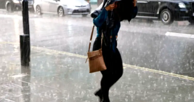
The Met Office has issued a forecast for heavy rain across 57 areas in the UK on Sunday as the ongoing heatwave begins to break. Temperatures are expected to drop by up to 15°C, returning to more seasonal averages. The forecaster attributes the change to a “westerly influence” bringing cooler, wetter conditions.
Scotland to See the Heaviest Rainfall
Scotland is predicted to receive the most significant rainfall, with areas such as Caithness, Sutherland, Ross and Cromarty, Invernesshire, Nairnshire, Moray, Aberdeenshire, Perthshire, Argyll, Stirlingshire, and Dunbartonshire all affected. Further south, Ayrshire, Lanarkshire, Midlothian, Peeblesshire, Dumfriesshire, Kirkcudbrightshire, and Wigtownshire are also forecast to see showers. Most rain will be light, around 0.5-1mm per hour, but some parts of the Highlands could experience 4-8mm per hour, with isolated areas reaching 8-10mm per hour.
Rain Moving Eastwards Through the Day
According to the Met Office weather map, rain will begin in the early hours along the west coast and move eastwards as the day progresses. By 4pm, eastern areas such as Lincolnshire, Cambridgeshire, and Norfolk are expected to see showers, with Lincolnshire possibly facing heavier downpours. In England, Cumbria is forecast to have the heaviest rain, with up to 16-32mm per hour. Light rain is also expected across Cornwall, Devon, Kent, Essex, Suffolk, Yorkshire, and Tyne and Wear.

Wales and Northern Ireland Also Affected
Wales is predicted to experience widespread showers in the early morning, covering Cardiff, Pembrokeshire, Carmarthenshire, Ceredigion, Denbighshire, Gwynedd, Anglesey, Monmouthshire, Neath Port Talbot, Powys, and the Vale of Glamorgan. Most rain will be light, but central areas may see heavier bursts. In Northern Ireland, all six counties—Antrim, Armagh, Down, Fermanagh, Londonderry, and Tyrone—are expected to have scattered showers, with Londonderry seeing the most widespread rainfall.
Weekend Outlook and Heatwave Context
The Met Office forecasts: “Still hot in the southeast on Saturday. Fresher conditions are gradually arriving from the west over the weekend, but they are accompanied by spells of rain and thundery showers. Drier by Monday.” This comes after record-breaking temperatures earlier in the week, with 36.1°C recorded on Wednesday, which may be surpassed on Thursday. The rain on Sunday marks a significant shift from the sweltering conditions.
Full List of 57 Areas Facing Rain
Scotland: Caithness, Sutherland, Ross and Cromarty, Invernesshire, Nairnshire, Moray, Aberdeenshire, Perthshire, Argyll, Stirlingshire, Dunbartonshire, Ayrshire, Lanarkshire, Midlothian, Peeblesshire, Dumfriesshire, Kirkcudbrightshire, Wigtownshire, Angus, Fife, East Lothian.
England: Cornwall, Devon, Kent, Essex, Suffolk, Yorkshire, Tyne and Wear, Merseyside, Manchester, Staffordshire, Herefordshire, Gloucestershire, Somerset, Lincolnshire, Cambridgeshire, Norfolk, Cumbria.
Wales: Cardiff, Pembrokeshire, Carmarthenshire, Ceredigion, Denbighshire, Gwynedd, Anglesey, Monmouthshire, Neath Port Talbot, Powys, Vale of Glamorgan.
Northern Ireland: Antrim, Armagh, Down, Fermanagh, Londonderry, Tyrone.