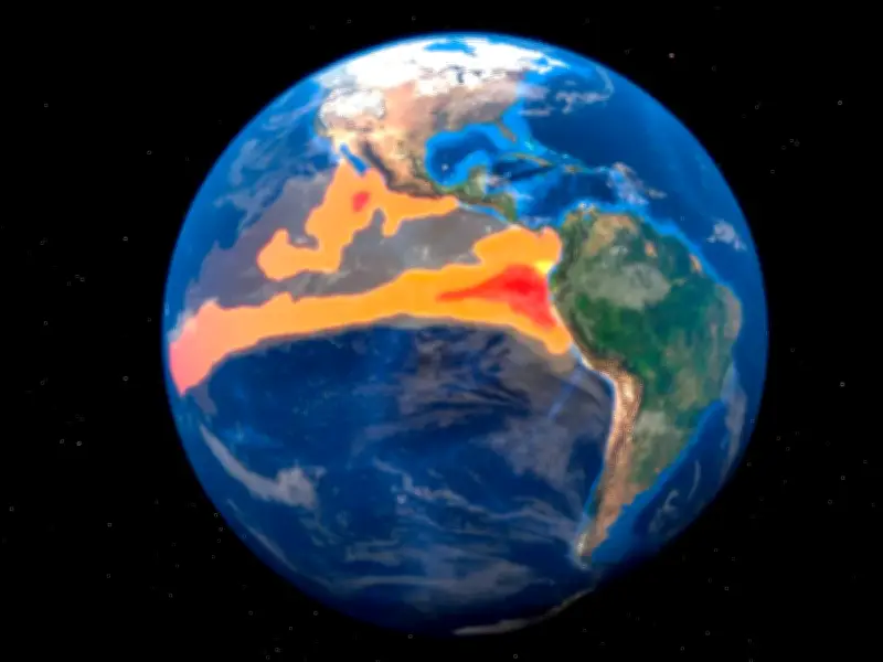
The intensifying Super El Niño has turned Earth maps red as scientists warn how long the devastating effects will last. Analysts warn the climate phenomenon has entered unprecedented territory, with many regions of Earth slated to bake in unseasonably warm temperatures. The balmy conditions are forecast to grip many parts of the planet as the Pacific Ocean releases massive amounts of stored heat.
El Niño to peak in December
World Meteorological Organisation (WMO) scientists now predict El Niño will build in strength ahead of a December peak. They claim it will then likely have a warming effect and influence rainfall across the globe in the next few months.
The impact is visible in weather maps that indicate El Niño could endure well into February next year. Meteorologist Ryan Maue said in a post shared on X/Twitter: "New maps show Earth almost entirely in the red. El Niño continues at 'maximum power' into the winter with planetary heating dialled up everywhere except the United States."
Warmest ocean on record
The WMO warned it could be the most powerful since 1950. Its secretary-general Celeste Saulo added: "El Niño is firmly established and strengthening rapidly. The ocean it's drawing from is the warmest we've ever measured it. There is simply more heat available to release."
Experts have warned the combination of a strong El Niño and warm oceans could rise in temperatures and spark floods and droughts in different regions of the world. The WMO forecasts the average temperature anomaly between October and December could hit about 3.7C with the height coming in December.
UK to face wetter, stormier conditions
Brits should expect heavy rainfall and floods, being triggered as early as October. According to MailOnline, Dr Amulya Chevuturi, the senior hydroclimate scientist at the UK Centre for Ecology and Hydrology said: "A strong El Niño is likely to increase the chances of wetter, stormier conditions for the UK from October to December. The North West is expected to be worse affected than the South East."
The increase in global average temperatures, particularly following the winter peak, could lead 2027 to replace 2024 as the warmest year on record, The Met Office said earlier this year. Professor Stephen Belcher is the Met Office’s Chief of Science and Technology. He said: "This summer we have experienced heat waves across Europe reminding us of the effects of climate change, this large El Niño is a reminder that natural variations in the climate system are also at play, adding to the stresses of climate change."