Scientists Predict Record-Breaking 'Super El Niño' Event This Year
Climate scientists are observing alarming indicators that suggest a massive El Niño event is developing this year, with potentially devastating consequences for global weather patterns and temperature records. This phenomenon, which occurs periodically in the Pacific Ocean, could reach unprecedented strength according to new modeling data.
Warning Signs From Climate Experts
Prominent climate scientist Daniel Swain recently stated on social media platform X that "all signs are increasingly pointing to a significant, if not strong to very strong, El Niño event." This assessment was reinforced by Washington Post meteorologist Ben Noll, who cautioned about likely changes in the location, intensity and frequency of droughts, floods, heat waves and hurricanes worldwide.
Noll's analysis, based on new modeling from the European Center for Medium-Range Weather Forecasts, estimates an 80 percent probability of a strong El Niño developing and a 22 percent chance of a "super El Niño" emerging by August. While these predictions remain uncertain, particularly during early spring forecasting periods, the potential impacts warrant serious attention from climate scientists and policymakers.

Understanding the El Niño Phenomenon
The term El Niño originates from South American fishermen who noticed periodic warming of Pacific waters around Christmas time, naming it "El Niño de Navidad" or "the little boy of Christmas." This natural climate pattern represents a disruption in normal Pacific Ocean circulation that occurs approximately every two to seven years.
During typical conditions, strong westerly winds push warm surface water from the eastern Pacific toward the west, allowing cooler water to rise from deeper ocean layers. However, during El Niño events, these winds weaken significantly, causing warmer water to accumulate in the eastern Pacific. This temperature shift creates massive updrafts of warm air that alter atmospheric circulation patterns across the Americas and beyond.
A "super" version of El Niño occurs roughly once every 10-15 years according to climate records, with particularly intense impacts on global weather systems.
Potential Impacts on United States Weather Patterns
The effects of a strong El Niño on U.S. weather, while sometimes unpredictable, typically follow certain patterns. The phenomenon generally elevates global temperatures as heat from the Pacific Ocean spreads beyond tropical regions. This could result in:
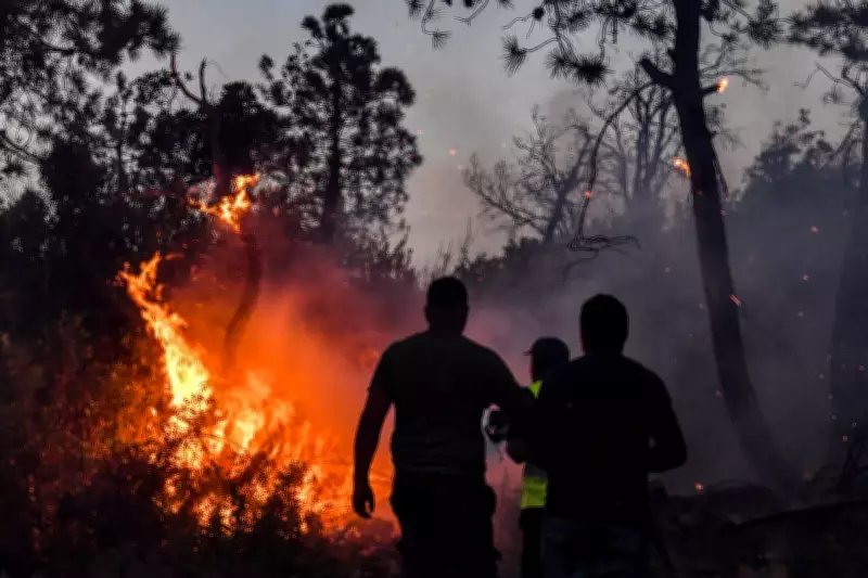
- Hotter-than-average summers in western states, potentially exacerbating wildfire seasons in California and Oregon
- Cooler summer conditions across the southern United States
- Wetter winters in western and southern regions, possibly providing drought relief but increasing flood risks
- Drier conditions in the Midwest
- Unusually warm temperatures in the Pacific Northwest
AccuWeather meteorologist Chat Merrill noted that "El Niño patterns could bring more rain than normal to the Colorado Basin" and that "the early start to the El Niño can lead to an increase in moisture from the southern Plains to East Coast during summer and fall."
Global Consequences and Climate Acceleration
Beyond U.S. borders, a super El Niño would likely suppress Atlantic hurricane formation while increasing Pacific storm activity, potentially affecting Hawaii and East Asia. Pacific Islands including Guam, Hawaii, and American Samoa typically experience drier conditions during El Niño events but face increased cyclone risks that could bring sudden, intense rainfall.
Perhaps most concerning is how a major El Niño event could accelerate global warming trends. Defense Department meteorologist Eric Webb explained to The Washington Post that "due to the increasing concentration of greenhouse gases, the climate system cannot effectively exhaust the heat released in a major El Niño event before the next El Niño comes along and pushes the baseline upward again."

The 2023/24 El Niño contributed significantly to 2024 becoming Earth's warmest year on record. Climate scientist Zeke Hausfather warns that a super El Niño in 2026/27 "would push up our estimate for 2026 global temperatures" and make 2027 very likely to become the warmest year on record.
Recent Climate Context and Regional Variations
These predictions follow federal meteorologists' findings that the winter of 2025/26 was actually the warmest on record for the continental United States, despite severe blizzards in the Northeast and Midwest. National Oceanic and Atmospheric Administration climate monitoring chief Russell Vose noted the regional disparities, stating that "the East, especially the Northeast, had winter" while "in the West, there were certainly places where you could say we missed the winter."
This pattern underscores how climate change creates unpredictable and varied impacts across different regions, with El Niño events potentially amplifying these effects. As scientists continue monitoring Pacific conditions, the potential for a record-breaking super El Niño remains a significant concern for climate stability worldwide.