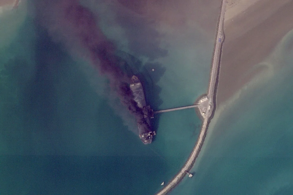
Satellite images from Planet Labs PBC have provided a rare glimpse into the devastation caused by the ongoing US-Israeli campaign against Iran, showing ships ablaze in an Iranian port and destroyed buildings at American bases. The conflict, which began on February 28, has seen limited information about damage inside closed military facilities.
In Bandar Abbas, home to a major Iranian military port near the Strait of Hormuz, images reveal significant destruction. The US Central Command claims to have sunk or damaged over 100 Iranian vessels since the war started.
Bahrain, where the US Navy’s 5th Fleet is based, has faced heavy Iranian fire. A March 1 image shows a major building destroyed at the base, along with two radomes—geodesic domes covering radar antennas—likely hit by Iranian missiles and drones.
In Abu Dhabi, damage is visible at France's Camp de la Paix naval base, with two large hangar-like buildings destroyed in a March 3 image. The base is located near Zayed Port and the Cultural District, home to the Louvre Abu Dhabi.
Lower-resolution imagery from the US Geological Survey’s Landsat satellites has also captured major fires. A fire at Dubai International Airport, caused by an Iranian drone strike on a fuel tanker, was seen on Monday. Another fire was detected at Oman's southern port in Salalah, which was attacked by suspected Iranian drones on March 11.
The US and Israel have targeted a wide range of Iranian assets, including leadership figures, military bases, and missile sites. Iran has responded with drone and missile attacks targeting Israel and Gulf Arab nations.