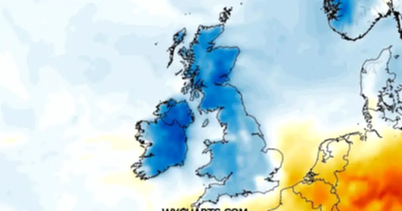
UK temperatures are set to fall sharply as a cold snap follows the recent heatwave, with weather maps from WXCharts showing a significant drop on Friday, July 31. The warmest area is expected to reach only 14C.
Chill hits Scotland and northern England
Some counties will plunge to 3C, with much of Scotland experiencing the coldest conditions. After highs of 32C, the rapid temperature change will make it feel even colder.
The UK Health Security Agency (UKHSA) has issued an amber heat-health alert for the East Midlands, East of England, South East and London, lasting until 9am on Thursday. The agency warned that rising temperatures may increase health risks, especially for vulnerable groups.
Met Office outlook
The Met Office notes that fresher conditions will arrive by the end of the week. Its Thursday forecast says: "Outbreaks of rain, locally heavy at times, will affect northern Scotland." For Friday to Sunday, it states: "Friday and the weekend will hold onto a fresher feel. There will be a lot of dry weather with some sunny spells, though one or two showers are also possible."
Parts of northern England will also be cold, with Greater Manchester seeing lows of 8C and the West Midlands below 10C. London highs are expected to reach 13C, with parts of Sussex climbing to 14C.
Counties below 5C
- Ross-shire
- Inverness-shire
- Aberdeenshire
- Angus
- Perthshire
Following the cold snap, there is a chance of further warm spells the next week, but not heatwaves. The Met Office says: "Temperatures closer to average, still the potential for some warmer interludes, especially in the south, although perhaps not the heat we have seen in recent weeks."