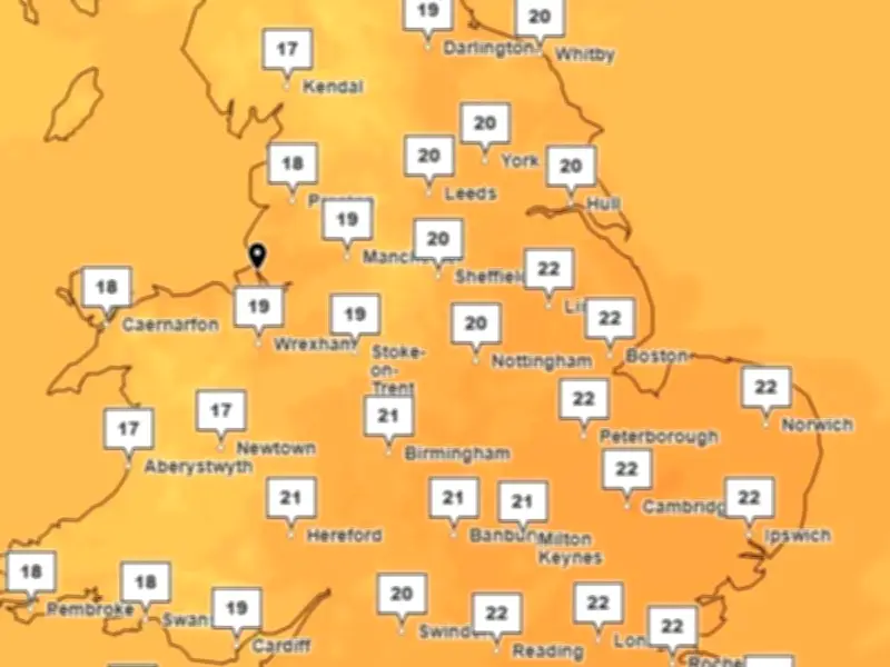
Despite autumn being well underway, temperatures across the UK remain unusually high, and the Met Office has explained why. September 2026 was the joint-fourth warmest September on record, and October is showing no immediate signs of cooling.
September's record warmth
Temperatures in September stayed around 20C, continuing this year's trend of above-average forecasts. The month was the joint-fourth warmest September in the UK record series, according to Met Office climate information scientist Mike Kendon.
Kendon said: “Persistent warmth has been the theme of recent months and September is no different. September 2026 was the joint-fourth warmest September on record in the series for the UK with high pressure particularly prevalent in southern areas later in the month.”
He added: “While the month itself was unexceptional overall, when putting it into the context of the warm year we’ve had so far, this fits with the general pattern that we’re seeing of more frequent above average temperatures in the UK as our climate continues to change.”
Mild October forecast
Mild conditions continue this week. For Liverpool, the Met Office forecasts a high of 19C on Monday (October 5) with a slight chill to 16C on Tuesday (October 6).
In its outlook for the week, the forecaster said: "Generally cloudy with spells of drizzly showers, although there may be some brighter spells in the afternoon, particularly in the south. A brisk breeze, particularly on coasts and hills, easing through the day. Feeling mild. Maximum temperature 19 °C."
Wednesday and Thursday will bring bright sunny spells with a cool, autumnal breeze, with showers most likely over mountains on Wednesday. A return to mild, unsettled weather is expected on Friday.
When will it cool down?
In its long range outlook, the Met Office said changeable conditions could be on the horizon, with a mixture of rain, winds and sunny interludes typical for this time of year. Despite this, temperatures are expected to be above average towards the start of November.
The Met Office said: "Late October into early November will probably maintain a changeable pattern overall with weather systems often moving in from the Atlantic. These will bring showers or longer spells of rain at times, with the wettest and windiest weather in the northwest, drier in the southeast."
It added: "There is a chance that a period of more widely dry conditions could develop for a time, but confidence in the details of this is low. Temperatures will probably be above average overall."