
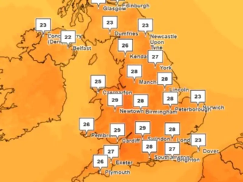
Wales is set for another heatwave next week, with temperatures potentially soaring to 36°C in parts of England, as the Met Office reports that high pressure "remains in charge" over the coming week.
After a brief dip on Monday, temperatures will climb again from Tuesday, staying mostly dry throughout. The hottest day is expected to be Wednesday, August 12, with forecasts suggesting temperatures "for the most part, temperatures look to remain above average, especially in the south, and perhaps turning very warm or hot".
Temperature forecast
Monday is expected to see highs of 27°C to 29°C, before rising day by day. On Tuesday, highs of up to 30°C are possible across parts of England and Wales, increasing to 32°C to 34°C on Wednesday. The highest temperatures are currently expected on Thursday, when 36°C could be seen in parts of East Anglia and south-east England.
Met Office forecaster Alex Burkill confirmed: "The rumours are true, it is going to heat up again next week with a lot of dry weather still to come."
High pressure from Europe
High pressure from Europe looks set to push up from the south, bringing dry and hotter weather to more central areas. The Met Office's deputy chief forecaster Mike Silverstone said: "Temperatures will climb through the weekend and, more significantly, through much of next week. After a brief dip on Monday, high pressure will move across the UK before settling to the east, allowing a southerly flow to develop.
"A fairly widespread heatwave is likely across large parts of England and Wales, with hot conditions developing in places. The heat is expected to peak for much of England, Wales, Northern Ireland and Scotland on Wednesday, with up to 34°C possible in parts of central and southern England and southeast Wales. East Anglia and south-east England, however, could see temperatures even higher on Thursday.
"Humidity levels are also expected to increase through the week, which may make conditions feel more uncomfortable, particularly overnight."
Health advice and long-range outlook
With temperatures expected to rise again, people are advised to take sensible precautions in the heat, including staying hydrated, avoiding prolonged exposure to the sun during the hottest part of the day, and checking on vulnerable friends, family and neighbours.
Looking further ahead, the Met Office long range forecast says that further into August, "lower pressure may start to track further south or east". It adds: "This means there is a greater chance of frontal systems or thundery interludes to affect southern and eastern areas in comparison to recent weeks, though rainfall amounts could be quite variable with some areas still seeing relatively little.
"Temperatures look to remain above average, especially in the south, where perhaps very warm or hot." Towards the end of August and start of September it also says: "The broad theme of high pressure remaining in place at least close to the UK seems most probable, with occasional more unsettled or changeable interludes, either resulting from Atlantic frontal systems or thundery plumes."




