
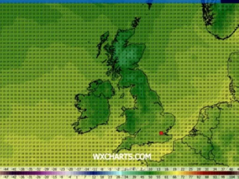
The UK is bracing for a dramatic temperature plunge after weeks of scorching heat, with forecasts indicating that the mercury could drop as much as 11°C below the July average. According to WXCharts, July 28 will see a significant cooldown, with some regions experiencing lows of just 6°C.
Regional Temperature Breakdown
The south of England and East Anglia will be the warmest areas, with highs of 14°C to 15°C expected in cities such as Norwich, London, Canterbury, Oxford, Bristol, Portsmouth, and Exeter. The Midlands and parts of northern England, including Birmingham, Nottingham, and Manchester, will see temperatures ranging between 12°C and 13°C. Wales (including Cardiff and Conwy) and Northern Ireland (including Belfast and Derry) will experience highs of 10°C to 12°C.
However, the north of England and the south of Scotland will be significantly colder, with temperatures dropping to single figures in Newcastle, Carlisle, Edinburgh, and Dumfries. The coldest regions will be central and northern Scotland, including Inverness, Aberdeen, and Wick, where 6°C is likely.
Comparison to July Averages
England's average July temperature is around 24°C, while Scotland's average maximum is approximately 17°C. The forecasted figures represent a staggering 11°C below the seasonal norm, according to the Express.
Met Office Forecast
The Met Office has issued its own outlook for the period. A spokesperson stated: "Dry on Friday for most with sunny spells. Northern and northwestern areas will be cloudier with occasional patchy rain or drizzle. Into the weekend and perhaps the start of next week, more unsettled weather with rain at times, especially across northern parts of the UK. This rain may very well reach southern areas too, but could become more light and patchy here."
The forecast continues: "Confidence becomes lower as we approach the turn of the month, but there are signs that high pressure will return, which means dry conditions would resume, especially in the south. Winds will be mostly light or moderate, occasionally fresh around northern coasts. Temperatures are expected to be near or above normal, warmest in the south, perhaps becoming very warm again by the start of August."
Five-Day Forecast
The Met Office's five-day forecast predicts: "This Evening and Tonight: Staying cloudy for Northern Ireland and northern Scotland with light and patchy drizzle, mostly around coasts and hills. Dry and clear elsewhere and much cooler than recently in the south. Monday: Cloudier than recent days, though sunny spells will develop through the afternoon. Cloudiest in the north and northwest, with some light rain or showers. Warm in central and southern Britain. Outlook for Tuesday to Thursday: Staying settled through the week with patchy cloud and the odd shower in the north. Staying warm to very warm with temperatures in the mid to high 20s."




