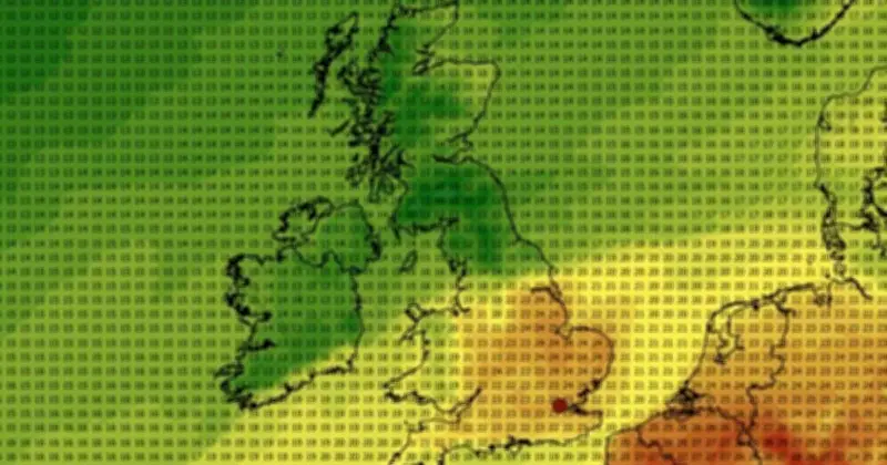
A weather map of the UK shows top temperatures in the mid-20s Celsius on September 5, with 25C forecast in Lincolnshire at 6pm and 22-24C across a vast swathe of England. The map, generated on Sunday (August 30) by WX Charts using data from the European Centre for Medium-Range Weather Forecasts, covers some 32 counties.
The same map shows cooler conditions in the North of England, South West England, Wales and Scotland, where temperatures range from 11-14C in the north of Britain to the high teens in western parts. Another map generated by WX Charts using Met Office data shows a similar range, but southern counties appear a degree or two cooler, with central England looking set to be the warmest region at 23-24C.
Forecasters caution against heatwave expectations
The Met Office's long-range forecast, covering September 3-12, suggests temperatures are "likely" to be near average, but some warm or very warm spells are "possible", particularly in the south. However, these would be short-lived and the period is likely to remain unsettled as most areas will see showers or longer spells of rain.

There is no mention of a heatwave in the long-range forecast issued by the Met Office, which defines this as being when a place records a period of at least three consecutive days when daily maximum temperatures meet or surpass a heatwave threshold.
Mixed outlook from other forecasters
Netweather's long-range forecast for August 31 to September 6 describes an "ordinary pattern", with low pressure moving west to east in northern Britain and high pressure ridging into the south at times. It adds: "Temperatures early in the week will generally be close to the seasonal norm, though perhaps a little above in eastern England."
Later in the week, a northwest-southeast split develops, with "frequent" wet, windy weather to the northwest and "drier, quieter" weather in the southeast, according to Netweather. The same forecaster suggests rainfall will be above normal for most regions and mean temperatures are forecast to be a degree or 2C above the long-term average in eastern England, but close to average in most of the west.
Counties expected to see 22-25C on September 5
BBC Weather reports a similar picture, with "most areas" wetter than average and temperatures "more likely" to be near or just above "normal" for the time of year. This forecaster says it will be warmer in the south, especially towards the end of the coming week.
Counties where maximum temperatures will range from 22C to 25C on September 5 include Lincolnshire, Cambridgeshire, Norfolk, Suffolk, Essex, Kent, East Sussex, Bedfordshire, Hertfordshire, Greater London, Surrey, West Sussex, Buckinghamshire, Northamptonshire, Berkshire, Hampshire, Rutland, Oxfordshire, Wiltshire, Dorset, Gloucestershire, Warwickshire, Leicestershire, Somerset, South Yorkshire, Derbyshire, Nottinghamshire, Cheshire, Shropshire, Herefordshire and Worcestershire.