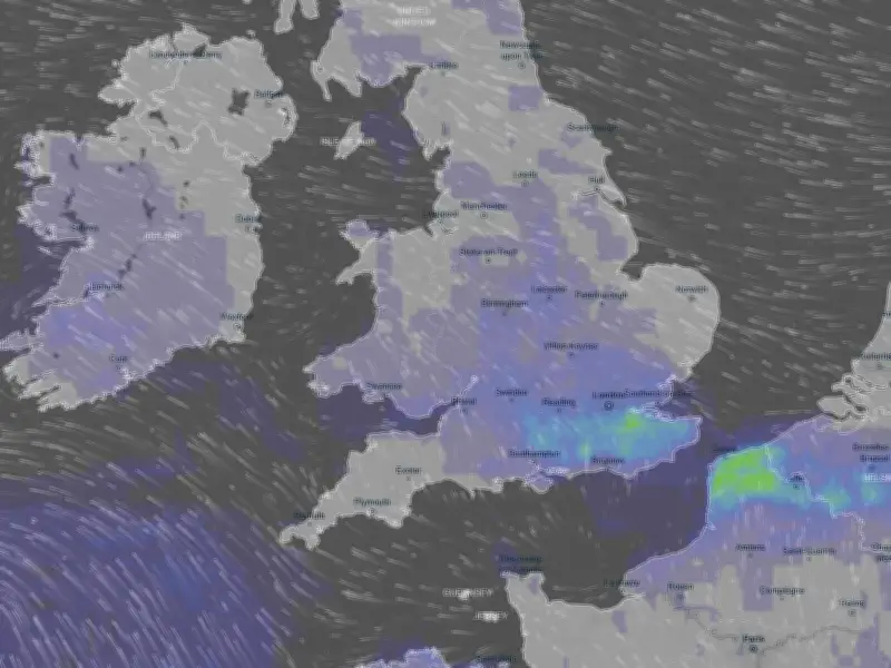
Thunderstorms are expected to hit at least 16 counties across England in just two hours on Wednesday, according to weather modelling data. The Met Office has already issued two weather warnings for this week, covering 59 areas across England and Wales.
Wednesday's storm timeline
BBC Weather says thundery showers are expected in southern parts of England and Wales tonight, before progressing slowly northwards tomorrow. Some showers are expected in Northern Ireland and southern Scotland by the afternoon and evening, the BBC adds.
Weather modelling data suggests the south and south-east will see the worst of the thunderstorms at around 2pm on Wednesday, with London potentially in line for heavy rain. Just two hours later at 4pm, the models show potential thunderstorms stretching as far north as Staffordshire.

In total, the data suggests 16 counties could see serious thunderstorms across those two hours: Sussex, Surrey, Kent, Middlesex, Hampshire, Wiltshire, Buckinghamshire, Berkshire, Essex, Bedfordshire, Northamptonshire, Warwickshire, Leicestershire, Derbyshire, Staffordshire and Nottinghamshire.
Met Office warnings and forecast
The Met Office forecast is very similar to BBC Weather, predicting “heavy showers and thunderstorms” will develop tonight, potentially reaching Northern Ireland before Wednesday. For Wednesday, the Met Office adds: “Bands of heavy showers and thunderstorms will continue to move northwards through the day. Sunnier moments in between, where it will feel very warm and humid, especially in the south.”
The Met Office has issued a weather warning for thunderstorms on Wednesday, spanning 59 areas across England and Wales, in place from 3am until 10pm. A second warning has been issued for Thursday, when further rain and thunderstorms are expected, with northern areas most at risk.
Spanish plume explained
BBC Weather said a “Spanish plume type of system” could be responsible for the thunderstorms this week. This meteorological term refers to warm air moving northward from Spain which rises and cools, leading to the formation of thunder clouds in the UK.
The Met Office explains: “As cooler air spreads from the west, instability increases and the very warm air rises through the cooler air, enhancing the formation of thunderstorms.” Despite the storms, temperatures are expected to remain above average this week, potentially peaking at 28C in southern areas on Wednesday.