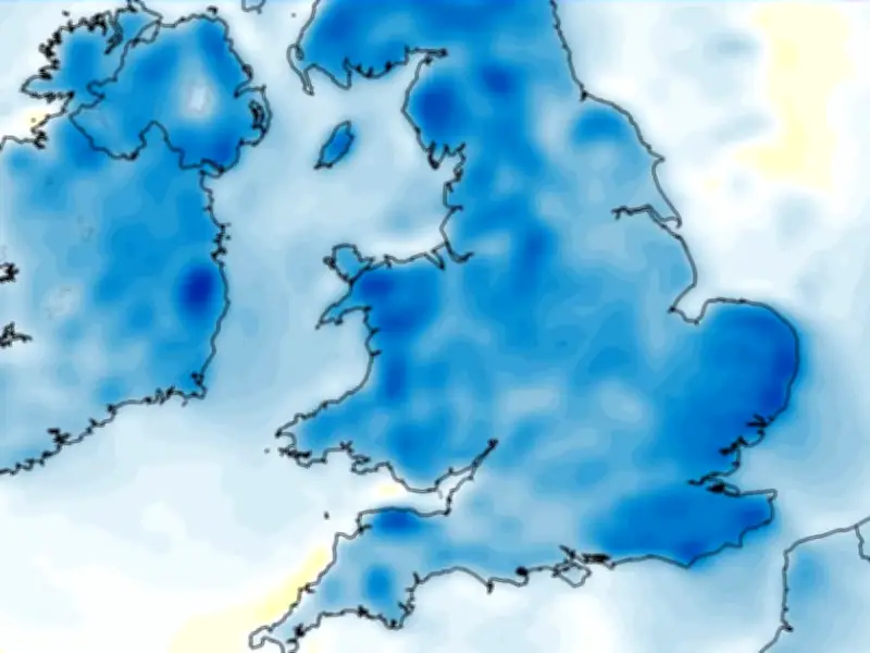
Weather forecasting models suggest a cold snap is on its way to the UK next month, with daytime temperatures potentially dropping below 10C right across the country. Temperature anomaly maps for October 15 and October 16 show the UK shaded in areas of blue, indicating where temperatures are expected to drop well below the seasonal average.
Chilly afternoon highs
The GFS weather model shows afternoon temperatures peaking at just 9C in London on October 15, with 8C in the Midlands and South Wales, 7C in the north-west, and 6C in central Scotland. There may only be a handful of places in the south-west that see double-digit temperatures, the data shows.
Similar conditions are expected on October 16, with minimum possible temperatures of 9C or below on the cards across all 92 counties at midday. By 6pm, the GFS model data again shows just a handful of areas - primarily in Northern Ireland or southern England - reaching 10C.
Met Office outlook
Met Office weather forecasters expect temperatures to be slightly above average for October as a whole, but also warn that "cooler interludes" are on the cards next month.
"It will likely be quite changeable through the middle of October, as a series of low pressure systems run across the North Atlantic, often to the north and northwest of the UK, bringing occasional bands of rain and strong winds, but interspersed with brighter and more showery conditions," the Met Office says in its forecast for October 11 to October 20.
"Rain will be most prevalent across hills in the west and especially northwest, where above average rainfall is likely through this period. Longer drier interludes are more favoured in sheltered southern and eastern parts, but even here it is likely to be wetter than during recent weeks.
"Whilst brief cooler interludes are possible, temperatures are likely to be a little above average in many areas for the period as a whole."