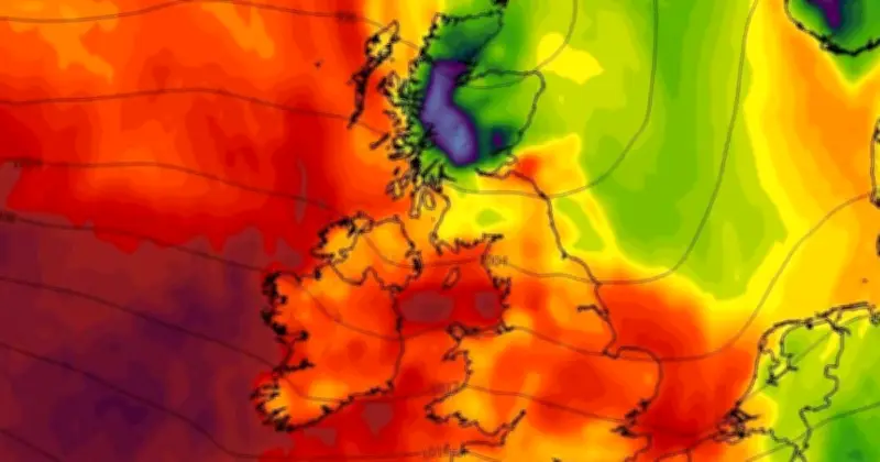
New weather maps from forecaster WXCharts warn of strong winds and heavy rain this coming weekend, with conditions arriving within hours. Wind speeds could reach up to 60mph in parts of the UK, with Scotland expected to be the worst-affected region.
Wind and rain warnings for the weekend
The latest maps show winds of up to around 96kmph, approximately 60mph, across a large section of Scotland. Winds could also reach around 43mph in the Midlands and Wales. The forecaster's data indicates heavy rain covering most of the UK on Friday morning, except for a small section of the South East, with the heaviest falls in the west of the country.
The Met Office has warned of wet and windy conditions from this evening into the weekend, following a week of heavy, consistent rain across several parts of the UK.
Met Office forecast details
According to the Met Office, tonight will see conditions become increasingly windy with spells of rain or showers. The forecast states it will turn "increasingly wet and windy overnight with the heaviest rain in the north and west," while the south will be "occasionally damp" but generally drier.
For Friday, October 8, the Met Office predicts "a windy day with gales on coasts and more widely over northern hills at first," along with "spells of rain, clearing south with cooler, sunnier weather and showers following from the north."
Outlook for the week ahead
The forecast for Saturday through Monday reads: "Windy with sunny spells and showers on Saturday and feeling rather cold in the north. Brighter and calmer on Sunday before turning milder with some rain in places on Monday."
From Tuesday onward, the forecast adds: "Remaining changeable through the middle of October, as a series of low pressure systems run across the North Atlantic, often to the north and northwest of the UK, bringing occasional bands of rain and strong winds, but interspersed with brighter and more showery conditions."
"Rain will be most prevalent across hills in the west and especially northwest, where above-average rainfall is likely through this period. Longer drier interludes are more favoured in sheltered southern and eastern parts, but even here it is likely to be wetter than during recent weeks."