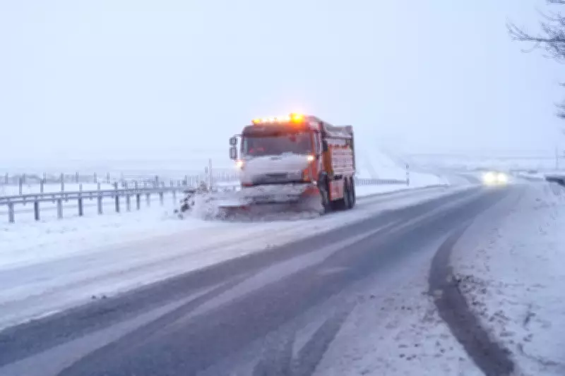
The Environment Agency has issued a stark warning for the public to remain vigilant as the United Kingdom faces a dual threat of severe winter weather and widespread flooding. Yellow snow and ice alerts have been activated across extensive regions, while more than 70 areas are under flood warnings, creating hazardous conditions for travel and daily life.
Active Weather Warnings and Flood Alerts
On Sunday morning, a significant snow and ice warning remained in effect for most of Scotland and large parts of England until 10am. Additionally, a new snow warning was issued for parts of eastern England, valid from 10am until 4pm. This follows a series of warnings that expired throughout Saturday, indicating persistent and evolving weather challenges.
Simultaneously, the Environment Agency reported 74 flood warnings and 162 flood alerts across England. Jonathan Day, the flood duty manager at the agency, highlighted that while over 24,000 homes and businesses have been protected by flood defences, approximately 330 properties have already been inundated. This underscores the ongoing risk and the need for continued caution.

Detailed Forecast and Potential Disruptions
The Met Office has provided specific details on the expected snowfall. The yellow warning for snow and ice, stretching from Derby across the majority of Scotland, predicts accumulations of 1-3cm at low levels, with 3-7cm possible above 150 metres elevation, and up to 10-15cm above 400 metres. Snow in these areas might be "heavy at times," potentially causing "some disruption to travel."
Ice is noted as an additional hazard, particularly in north-east England and parts of Scotland, where precipitation could fall on frozen ground, leading to "very slippery conditions." The Met Office warns that snow will turn increasingly to rain into Sunday morning, possibly as a short spell of freezing rain, before clearing to the east with a steady thaw of lying snow.
For eastern England, the snow warning indicates that "a spell of snow may lead to some disruption to travel." Rain moving eastwards through Sunday morning is likely to turn to sleet and snow, with slushy accumulations of 1cm or so expected, and a chance of 2-4cm in areas like the Lincolnshire Wolds and parts of Norfolk and Suffolk if snow turns briefly heavier.
Broader Weather Patterns and Outlook
Met Office meteorologist Greg Dewhurst described Sunday as having a blustery start for many, with outbreaks of showery rain and some hill snow. Milder air will move into the South West, with parts of Cornwall and Devon potentially reaching 12°C, while eastern areas will experience cooler temperatures around 4°C or 5°C.
Looking ahead, next week is forecast to bring unsettled and blustery conditions with showers across the entire country. These are expected to ease into Tuesday, but another weather system will arrive on Wednesday, bringing more unsettled weather. Thursday is anticipated to be drier, offering a brief respite from the current turbulent patterns.
Residents are advised to stay updated on local warnings, avoid unnecessary travel in affected areas, and take precautions to protect property from flooding. The combination of snow, ice, and flood risks highlights the importance of preparedness during this period of adverse weather.