
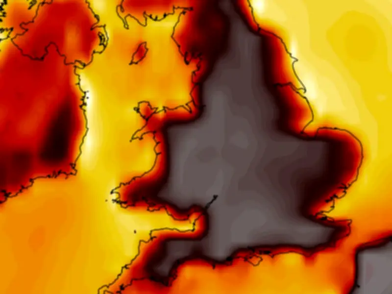
Weather forecasting models suggest the UK could experience its hottest day of the year so far next week, with temperatures potentially surpassing 37C in eight English counties.
Forecast details
The current 2026 record stands at 37.7C, recorded on June 26 in Lingwood, Norfolk. According to the GFS weather model, maximum temperatures could reach 34C on Wednesday in southern England, stretching from Gloucestershire to Surrey. South Wales might see 31C, while the Midlands could reach 33C.
By Thursday, highs of 36C are possible widely across western and southern England, with 33C in Yorkshire and 28C in southern Scotland.
Peak temperatures
Western and south-east England could see at least 37C on Friday, with 36C possible across central and southern areas. Saturday maps show potential highs of 36C in East Anglia and the south-east, 33C in Yorkshire, and 33-34C in the Midlands. This hot spell would constitute an official heatwave across the four days.
Temperature anomaly maps indicate the UK will be shaded deep red, showing temperatures well above the seasonal average.
Counties at risk
Eight counties in England are forecast to reach 37C or more: Worcestershire, Warwickshire, Gloucestershire, Buckinghamshire, Berkshire, Hampshire, Surrey, and Sussex.
Met Office outlook
The Met Office says conditions could turn 'very warm or hot' again later this month, but there is also potential for 'thundery interludes'. The forecast for August 9 to 18 states: "Further into August, high pressure may become more dominant towards the north or northwest of the UK, with lower pressure to the south or east. This means there is a greater chance of frontal systems or thundery interludes to affect southern and eastern areas in comparison to recent weeks, though rainfall amounts could be quite variable with some areas still seeing relatively little. For the most part, temperatures look to remain above average, especially in the south, and perhaps turning very warm or hot."




