The Met Office has issued two thunderstorm warnings for Greater Manchester this week ahead of heavy downpours. The first warning covers Wednesday, and a new warning has now been issued for Thursday.
Wednesday warning details
The Met Office firstly issued a 19-hour thunderstorm warning for parts of the region from 3am on Wednesday until 10pm in the evening. The yellow weather warning was issued ahead of heavy and persistent rain forecast throughout the day.
In areas covered by the warning, the Met Office said there is a 'small risk of flooding and disruption from thunderstorms'. Areas covered include parts of Trafford, Stockport, Tameside, Oldham and Rochdale.

Thursday warning issued
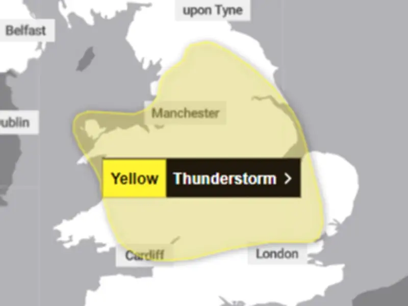
A new thunderstorm warning has now also been issued for Thursday. This yellow weather warning comes into force at 6am on Thursday morning until 10pm in the evening. "Thunderstorms and heavy rain may lead to some disruption", the Met Office said. This covers all of Greater Manchester as well as large parts of England and Wales.
Outlining the details of Wednesday's warning, the Met Office said: "A band of heavy showers and thunderstorms is expected to move northwards on Wednesday morning."
"A drier, brighter interlude may follow, but with a chance of further showers and thunderstorms breaking out during the afternoon. Many places will miss these, but where they do occur they may be intense with 20-30 mm rain falling in less than an hour and perhaps 40-50mm in 2-3 hours in a few spots, leading to some surface water flooding."
Potential hazards
"Large hail and frequent lightning are also possible. The showers and thunderstorms will drift northwards and ease during the evening."
On Thursday's warning, the forecaster said: "A band of thunderstorms and heavy rain will move north across England and Wales, perhaps becoming slow moving in the afternoon and evening. Accumulations of 20-30 mm in three hours can be expected fairly widely and up to 50 mm in a 12 hour period can be expected in places."
"There is a small chance that some places may see more than 50 mm in three hours and more than 75 mm through 12 hours, especially over east facing high ground. Lightning and hail of 1-2 cm will also be hazards."